Search
21 results found with an empty search
- The Rebellion Way
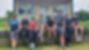
If you're looking for a 230 mile adventure where either the mile-munching friendly banter between old mates or the peaceful solitude of being at one with the bike speeds the journey along, then this is the route to choose. Day 1 - Oxborough to Heacham Cycling UK's, Rebellion Way officially starts in Norwich, although being a circular route, kicking off at any point on its 230 mile circumference is entirely possible. It had taken us a good few weeks of prior head scratching to get the five of us from Surrey to Norfolk in an efficient manner. We were looking to maximise our annual leave and keep the daily riding distance and overall trip cost wallet friendly. We settled on four days riding and a start and finish in Oxborough which meant we were relatively close to the main road from London, whilst cleverly avoiding the honey pot towns for our overnight accommodation. Cars parked, bikes unloaded and bags strapped to racks, we quickly found ourselves rolling down quiet back lanes and sandy tracks. The entrance to a field provided a decent enough backdrop for the group photo then it was onto Swaffham, the first of a number of towns on the route. Although in past times the busy town was a place of fame, modern shops have slightly tarnished its former appeal. Still, its got plenty to offer the passing traveller with pubs, convenience stores and toilets, but as we were fresh into our ride we passed through and headed north towards the pre-Norman, former walled town of Castle Acre. At just over thirteen miles in, and the next significant stopping point some twenty miles further, Castle Acre's Wittles Cafe, enticed us to rest on the village green and enjoy tea and cake. Suitably fueled and up to speed with the surrounding 'Castle and Bailey' history via Roly's pristine copy of the guide book, we jumped back on the bikes and headed north. Hedge lined back lanes, forest double track complete with swathes of orange sand, a big puddle and a puncture at a ruined church, more or less summed up the next couple of hours. Norfolk is a vast patchwork of multifaceted greens, hundreds of thousands of fields edged with paths and roads. Every once in a while, a small village or collection of houses signify human habitation. Our route felt like a dot-to-dot puzzle, weaving it's way through the ancient managed landscape joining habitation to habitation. We joined part of the Peddars Way before turning left towards Bawsey Lakes. Then north again to pass by the eleventh century Church of St. James, before heading west and into the outskirts of Kings Lynn. In contrast to the last thirty miles, the next ten were spent riding through a series of merged towns. The run into King's Lynn along local cycle lanes and park side paths was pleasant enough and sitting on the harbour front was a welcome lunch stop. The route retraced its steps in part before turning northward through Gaywood, South Wootton and North Wootton, the end of this section signified by the 1138 mediaeval ruins of Castle rising. Next waypoint, the well manicured Sandringham Estate. Then, with lights at the ready, it was back into the lanes and onto Sedgeford and the seaside town of Heacham where our six berth caravan and evening meal awaited. Day 2 - Heacham to Sheringham Rain is tolerable when it starts part way through the journey. Stepping out into blustery showers first thing in the morning does take a slightly hardy demeanour and degree of self motivation, particularly as our first stop was to find breakfast. An internet search had revealed a number of likely candidates and the Cliff Top Cafe and Beach Shop in Old Hunstanton, just five miles away, was a good find. Thankfully, in the time it took us to consume our various egg and bacon interpretations, the rain eased and the sun emerged from behind the grey coastal cloud. It was ten miles to Burnham Market and another ten to Wells-next-the-Sea. So with everyone now fuelled we set off on the north coast leg of our adventure. The route to Burnham Market avoids the coast road, which is a bit of a shame, but understandably the A149 can be busy and doesn't actually afford a true coastal view anyway. With no need to stop for provisions, we passed through the old market town and pressed on. Like much of this north west corner of Norfolk, the land is made up of a number of large country estates, their brick or flint stone walls signifying a passage around one vast perimeter or another. Today was the turn of Holkham Hall, the 18th century home of the current Earl of Leicester. After negotiating its slimline metal access gate we were met with an impressive two mile long drive, complete with imposing stone obelisk. After Holkham it was onto Wells-next-the-Sea, along what was probably one of the prettiest sections of the route following a pine wood gravel path next to Holkham Beach. We'd skipped the recommended Lookout Cafe at the western end of the nature reserve but succumbed to ice creams at the cafe near the Coast Watch Station. It was nearing lunch time so a brief stop in the main town filled our panniers with artisan (priced) baguettes and sweet delights from the bakery. This part of the Norfolk coast is always a popular tourist destination and today was no different, so we pressed on to eat in the relative seclusion of the village green at Great Walsingham. The next sixteen miles were fairly uneventful. Little Walsingham was very pretty and worth a stop if you fancied a sit down meal. More quiet back lanes, a couple of main roads and a smattering of gravel tracks followed until we arrived at Holt at around 4pm. A short break for weary legs opposite the Kings Head and then onto to Fish and Chips at The Two Lifeboats and an overnight stay at YHA Sheringham. Day 3 - Sheringham to Diss For some ungodly reason we'd decided to get up at 6am. The general plan was sound - try and finish todays 75 miles sometime before midnight. But swinging tired legs over the cross bar this early didn't feel like a holiday. So, as breakfast at the YHA wasn't served until 8am, we stocked up at the local Tesco superstore on our way down to the pretty harbour front in readiness for breakfast en-route. The route turned off-road fairly quickly with a steep ascent into Beeston Regis Heath, the wooded hills south of Sheringham. After struggling to find the route at the junction of the house and bridle way at Calves Well Lane, our party managed to get split up as we sought to find an alternate route to the top. Whilst three of the group pressed on through the woods, Paul and I managed to bag the view point and were rewarded with blue skies and a stunning coastal view. Picking our way through the woods was fun. A further mix of lanes, a busy stretch of road and more forest tracks took us to the rather grand, if some what austere, Felbridge House and the perfect spot for breakfast. The next fifteen miles were typical Norfolk quiet lanes - hedge lined in places - all with expansive views over a mix of arable produce. In contrast to yesterday's wet start, we were blessed with blue skies and a warm Autumn sun, just right for short sleeves and making the miles roll by. Blicklington Hall's impeccably manicured front lawn and surrounding buildings made for a convenient backdrop to the days Instagram photo and a useful pause to check the map for the next part of the route, the Bure Valley Railway. It was 11am and we'd covered twenty miles so far. As ever, the local bakery in Aylesham lured us in with sweet treats, tea and coffee but the town had a distinct lack of seating, so we didn't stay long. This next section was formed of a nine mile path running alongside the miniature railway line that connected Aylesham to Hoveton and provided a timely alternative from the Norfolk lanes. It's been advised that this section of the route can get busy with walkers and being only about a bike width in many places could be slow going. However it was a weekday morning for us and we pretty much had the path to ourselves. We'd set ourselves a 9am cut-off at Erpington and an 11:30am cut-off at Wroxham. These were both points at which we could shorten the official route to make up time. We'd hit the first but were thirty minutes behind the second. The decision was whether to pedal straight to Norwich via Salhouse or to include the Ranworth dogleg and make up the time elsewhere. With a trump card in our back pocket and good weather on our side we made the decision to stick with the official route. Our 2pm lunch was a mixed feast of burgers, left over sausage rolls from the bakery, plates of chips and pints of beer at the Maltsters in Ranworth right next to the picturesque Norfolk Broads. I guess the culmination of two and a half days of riding and three early starts were beginning to show as we munched our way through our pub grub in lazy fashion putting aside the fact we were only just over halfway through the distance for the day. We rolled past Norwich Cathedral at around 3pm and had decided to play our trump card, the fifteen minute train ride which runs from Norwich to Diss, cutting out twenty five miles of picturesque but all-to familiar Norfolk back lanes. It was absolutely the right call. After all, this was an adventure, not a bike slog and given our group has been adventuring together for over thirty five years none of us had anything to prove. After purchasing tickets, bike reservations and a short wait before boarding the train, we eventually stepped out at Diss station comforted by the fact it was only three miles to our pub lodgings, a meal and a shower. Twin room partners selected and the bikes crammed into the rather magnificent "olde-worlde" Scole Inn foyer we dined on red meat and beer before heading to bed. Day 4 - Diss to Oxborough It was another early start. Yesterdays rain had been replaced with an autumnal chill and our waterproofs now served as a useful thermal layer this time. First stop was to hunt for breakfast - which had now become our daily routine. Last nights lodgings were only a mile or so off route, so as the promising sky turned from patchy blue to grey we rolled into Diss high street to be met by the ever friendly Greggs the baker. The route today once again had a number of long sections devoid of food or drink so we stuffed our panniers with cakes and sandwiches and trundled off westward aiming for our first check point - the small village of Hopton. The miles just rolled by, most of us now comfortable with the dynamics of our ever morphing mini peloton. Our conversations were interrupted by shouts of 'left' or 'right' and we understood that the topic of discussion would fit around everyones pace as we rode up or down the rolling terrain. Hopton came and went, a contradictory crossroads with a generous modern corner store opposite a 14th century church. Before we knew it we were dodging heavy lorries for the two minute stint on the A1066 Thetford road before turning onto quieter lanes and the first of many acres of Thetford Forest. Our party had split up due to conflicting GPS directions and while phoning each other to agree a rendezvous point, three of us happened to come across an elaborate water pumping tap and a herd of white deer near St. Andrew Church. After several minutes of playing with our camera's maximum zoom and steady hands to get a photo, we pressed on stopping briefly at Thetford's Tesco superstore before heading north east on our zig zag route through Thetford Forest. The next twenty five miles were a pleasant ride through some quiet forest tracks and bracken-lined woodland roads, interrupted only by the sound of afterburners from the supersonic fighter jets based at RAF Lakenheath and the odd car. We stopped for lunch on a generous grassy corner, again for an afternoon snack at the Shepherds Baa woodland cabin, and once more for a group photo at the Desert Rat memorial. Four days and 230 miles later we rolled past the sign to Oxborough and our waiting cars. For some, it was their longest single ride. For everyone, it was a well earned achievement. How to ride the Rebellion Way Route The Rebellion Way blends quiet back roads, byways, cycle paths and bridleways into a 230 mile (370km) circular route. Norfolk isn't entirely flat but there's nothing particularly steep and the off-road sections are all manageable in good weather on a 35mm touring tyre. Clicking on the map (title) above takes you to the Ride with GPS route we used for this adventure. Please feel free to download and modify to suit. Alternatively you can download the official route from CyclingUK here. We started at Oxborough, which is in between Thetford and Kings Lynn. This allowed us to access more reasonably priced accomodation away from the main hot spots with the benefit of enjoying the major towns and cities at lunch time rather than at the end of the day. We chose to undertake the trip over four days with the cycling distance on the first and last days slightly shorter to allow for travel to and from home. Day 1 - Oxborough to Heacham. 51 miles (82km), 550m ascent Oxborough, Swaffham 8, Castle Acre 13, Kings Lynn 32, Sandringham Estate 42, Heacham 51 Day 2 - Heacham to Sheringham 61 miles (98km), 783m ascent Heacham, Hunstanton 3, Burnham Market 14, Wells-next-the-sea 25, Little Walsingham 32, Holt 51, Sheringham 61 Day 3 - Sheringham to Scole 73 miles (117km), 795m ascent Sheringham, Rye 9, Aylesham 20, Buxton 24, Hoveton / Wroxham 30, Ranworth 37, Norwich 48, Stoke Holy Cross 54, Saxlington Nethergate 57, Scole 71. Day 4 - Scole to Oxborough 46 miles (74km), 440m ascent Scole, Diss 3, Hopton 12, Thetford 25, Foulden 44, Oxborough 46. Getting to the start The official start point is Norwich which is a great place to begin if you live locally or are heading up from London by train. Otherwise starting somewhere on the west side of the route, such as Thetford or Kings Lynn would be a better option. Diss is the stop before Norwich on the train from London, so again makes a good starting point. Terrain Approximately 80% paved & 20% unpaved The terrain is text book touring bike. Gentle rolling undulation, backroad tarmac and a smattering of gravelly byways. There's a little bit of mud in a couple of patches and a few stretches of sand that's probably best walked. Three of our group had chosen panniers over bikepacking bags and no one lost their luggage over the rougher trails. Whether it was Roly's beautiful Reynolds 725 Croix-de-fer, Paul's original Marin Bear Valley with much coveted retro parts, Tim's 3D printed wonder or Marcus' radioactive Pinnacle, almost everyone ran some kind of Schwalbe or Continental touring tyre around 35mm wide. I'd left my Adventure bike in its Brother in the Wild set up with 42mm Soma Cazadero's and suspension forks and, ironically, was the only one to suffer a puncture on the rough stuff! (Typical off-road terrain) When to go Naturally, the best months are from May to September, when the weather is at its best and all the local attractions and facilities are open. That said, the route could probably be ridden all year round as it's reasonably sheltered and mainly road based. The Norfolk back lanes can get a little bleak in winter but by splitting the route over say five or six days, and finding cosy pubs for over night accommodation, it could make it a cracking off-season adventure. Accommodation Due to the mixed riding ability within the group - and the fact it was a bit of a lads holiday - we chose not to camp. While this significantly reduced the amount of kit we needed to bring, it did quickly polarize the price of accommodation. The natural stopping points on the route generally coincide with the big towns where, surprisingly, room prices are quite expensive. We ended up starting and finishing in Oxborough which placed the natural overnight points in less cost prohibitive locations. We managed to bag three nights accommodation plus travel to and from the start for £100 each. Staying in the big towns would triple that amount. Day 1 - Lynton Caravan, ParkDean Resorts, South Beach Road, Heacham, Hunstanton, PPE31 7BD Day 2 - YHA Sheringham, 1 Cremer's Drift, Sheringham, Norfolk, NR26 8HX Day 3 - The Scole Inn, Ipswich Road, Scole, Diss, United Kingdom, IP21 4DR If you're touring on a budget, definitely consider camping. Eating Rather like the accommodation, eating does need a little bit of thought. In the main there's a good mix of cafe's, local shops, pubs and restaurants. We sampled all of these, including occasionally frequenting pubs more than once a day! However, there are long stretches of the route where you're well away from civilisation, so do check the route carefully and stock up ahead. Wittles Cafe, Stocks Green, Castle Acre, King's Lynn PE32 2AE Cobbles Tea Room, 5 Hanse House, South Quay, Kings Lynn, PE30 5GN Lynton Caravan, ParkDean Resorts, South Beach Road, Heacham, Hunstanton, PPE31 Cliff Top Cafe and Beach Shop, Lighthouse Cl, Hunstanton, PE36 6EL Well-next-the-sea Beach Cafe, Beach Road, Wells-next-the-Sea NR23 1DR The Two Lifeboats, 2 High St, Sheringham NR26 8JR Tesco Superstore, Cromer Rd, Sheringham NR26 8RS The Maltsters, The Hill, Ranworth, Norwich NR13 6AB Greggs, 22/24 Mere St, Diss IP22 4AD The Shepherds Baa, Lynford Rd, Mundford, Thetford IP26 5HW Convenience stuff Public toilets and convenience stores can be found in most of the main towns and villages along the route. A quick internet search at any point should bring up a number within a reasonable riding distance. Check for opening times for toilets as they can get locked up overnight and out of season. There are a number of cycle shops along the route, the majority located towards the northern part of the loop. Equipment The route is best suited to a touring, hybrid or gravel bike. Given our group dynamic, we chose not to camp, significantly cutting down on the kit we carried. We also shared common tools and equipment and carried a variation on the list below. This was my personal kit: Specialized CrossTrail "Adventure Bike", running 42mm Soma Cazadero tyres; a 40T x 11-46t drive train and suspension front forks (as set up from a previous off-road gravel event) Bikepacking bags (22ltrs total): Self-made rear bag system (2 x 8 ltrs), Wizard Works Lil Presto bar bag (1.8 ltr), Wizard Works Go-Go top tube bag (0.8 ltr), self-made frame bag (3ltrs), Topeak top tube bag, between top tube and seat post (0.5ltr), Specialized seat pack S, Amazon special stem bag/dump pouch. Cycling clothes: Helmet, gloves, glasses, cycling shoes, cycling shorts (bibs), overshorts, wool cycle jersey, cycle gilet, arm warmers, neck buff, waterproof jacket. Spare clothes: 1 x cycling jersey, 1 x bib shorts, 3 x socks, 1 x cycling cloves Overnight clothes: T-shirt, lightweight fleece, zip off trousers, socks, underwear, lightweight trainers Wash kit, towel and first aid items Mobile phone, GPS, GoPro, battery(s), charger, cables Bike tools, innertube, pump, lights, bike lock, bell 1.5 ltrs (2 x water bottles) carried on the bike, snacks Final thoughts Finding the best way to appreciate the Rebellion Way does take a bit of interpretation. Given that two thirds of the images in Cycling UK's guide book depict rugged bikes covering off-road sections (set against a current trend for all things "bike packing"), it would be easy to presume this is an off-road adventure. It's not. Around 80%, of the route is on tarmac roads so it really makes for a good old fashioned touring bike adventure. In fairness, the guide book wording does describe the terrain well enough but a picture speaks a thousand words, as they say. I'd say this is a bit of a Marmite route. If you're into your history or enjoy seeing how the upper class lived there's plenty to see. The landscape itself is pleasant - picturesque and easy on the eye. If you're looking for rugged coast line, epic views, ancient woods and steep sided valleys, this one isn't for you. I wouldn't recommend the route as a good introduction to bikepacking either, given there are more varied and engaging routes in the UK for a similar distance and terrain, (I'd thoroughly recommend the Canti Way for a first time adventure though!) Dig a little deeper though and you'll find a brilliant route to enjoy with friends, a trip where conversation and camaraderie makes the miles roll by. Or perhaps a solo ride, one to get away from life for a handful of days and reflect on nothing more than the wide open sky and the turning of your pedals. Which ever angle you choose, I'd recommend a few changes. Tweak the route to go through the towns to provide additional interest. Take a picnic into Thetford Forest or take a day off and explore Norwich. Don't be afraid to cut out some of the roads between Sheringham and Diss if it means you get to enjoy another slice of cake in the tea shop or a pint in the pub. This is a route that needs an accompaniment, a steak that needs a peppercorn sauce, if you will. Happy Adventuring!
- A River Thames Canoe Adventure
On a Tuesday evening in June 2018, a mate sent round the following message to our lads WhatsApp group: “Inflatable canoes, Lidl, central isle, £40, I’ve bought 2”. By Thursday we all had one, and predictably when a group of like-minded people are in receipt of a bunch of newly purchased river craft, a water based adventure must swiftly follow. A river adventure had been on the cards for some time and a few months prior I’d bought a superb paddling guide called “Paddle the Thames” by Mark Rainsley. It therefore made perfect sense to pick a suitable section of this river, pack our kit and set off on a two day overnight paddle adventure. Day 1 - Ferry Lane, Aston to Ferry Lane, Cookham As is invariably the case when four guys all with young families decide to go away together, there’s degree of understandable faff and compromise before we get going. But come 10am on Saturday morning we were busy at our Aston launch point dividing up essentials, inflating the canoes and ensuring anything we didn’t want to get wet was inside something waterproof. The launch was easy enough via the gentle slipway and an hour later we were heading downstream. Navigation is a doddle on the river, you really can’t go that wrong, so it’s more a case of ticking off the landmarks as you go and keeping check on progress towards our destination. So it was fair to say that most of the morning was spent learning how the boats handled and what sort of cruising speed we could expect. The boats weren’t exactly rigid, it was more akin to paddling an enclosed lilo and the relatively low travelling speed was a result of their blunt and rather floppy design which was easily affected by the surface breeze or the wake of other passing river craft. But for a boat costing £40 and the fact they were facilitating a river adventure, we were absolutely chuffed to bits. The river at Aston was perfect for our adventure; it’s about 40m wide with plenty of space for all river craft to pass and good towpaths if an emergency exit was required. We were aiming for the campsite at Cookham Lock some 15km away and at 3km per hour we were confident enough of an arrival around 5pm. We passed the tree covered and mysteriously named Magpie Island and spent probably a little too long recounting scenes from an Indiana Jones film as we explored some of its narrow backwaters. After detangling ourselves from the drooping willow trees we pressed on, rejoining the main channel and quickly arriving at the churning weir at Hurley Lock. Keeping well to the right we avoided its magnetic-like attraction and found a suitable point to alight for our first portage of the day. Hurley Lock was a great place to stop and stretch our legs, grab a slice of cake and at hot coffee at the café and, for some of us, to dry off. We’d decided to take three canoes between the four of us, myself and Marcus in one and Dan and Tim paddling solo. Inside our boat was relatively dry as Marcus and I were using half a paddle each – Canadian style - but the paddle drip stops didn’t work particularly well and when the paddle was used with a double blade - Kayak style - the water ran down the paddle into the cockpit meaning both Tim and Dan were soaked from the waist down. A short paddle down the river brought us to Temple Lock with an alighting point to the left and fast flowing weir to the right. We carried the canoes around the locks once again and took full advantage of the public toilet facilities. I was pleasantly surprised with the Environment Agency run locks and facilities – ok they’re not the most salubrious - but they’re functional enough with toilets, hand basins and showers taking away the inconvenience of having to find decent facilities on route. The launch points are low enough for a kayak to easily enter and exit the river and the paths and steps are all well maintained. There’s quite a sense on grandeur to the next section of the river. It’s lined with mature trees and equally mature old houses and the swans look perfectly at home gliding gracefully across the foreground. Arriving at Marlow we’d happened upon a school regatta. It was quite comical listening to the event marshals struggling to get a bunch of eager young lads to line up their rowing boats on the virtual start line. But seeing an opportunity to test our new river craft, we felt a race was in order. We hung back, well off to the side of the river, confident in our age and experience over the younger rowers, waiting for the starting gun to fire... I think we kept pace for all of about three meters before their boats sped past us to shouts of encouragement from competitive parents on the far bank. Marlow is a pretty town, even when viewed from the river, and its crescent shaped weir is equally as impressive. The nearby lock demanded another portage and, after a day of wet shorts and continually bailing out their boats, Tim and Dan decided to rejoin the water in a single canoe adopting the somewhat dryer paddling style myself and Marcus had enjoyed throughout the day. The river opened out at this point, our boats feeling somewhat dwarfed by the expanse of flat water, but an hour after passing Gibraltar Island, we arrived at the slipway on Ferry Lane next to Cookham Lock pretty much on schedule. A well-deserved dinner at “The Ferry” pub topped of the trio of “Ferry” names for the day before heading down to the campsite on the island at Cookham Lock. Day 2 – Cookham Lock to Windsor None of us appeared to be hanging around this morning and as breakfast was planned for a later stop, we were back in the water by nine o’clock. Cookham Lock is a narrow shortcut across the main curve of the Thames with trees pressed hard up against the banks their boughs drooping low into the water. With a low layer of early morning river mist and just the sound of birds to accompany us, it felt like we were paddling down the Amazon. The National Trust's Cliveden House is just on the other side of the river and although the bankside trees block a direct view there are a number of pretty, mock Tudor buildings closer to the water. Soon we were approaching Boulters Weir, an impressively large tier of steps with crashing water and ominous “Danger” signs protecting its entrance. Staying well to the right we avoided the natural pull of the water and docked at our alighting point. Although this is an island, much like many of the other locks, it is connected to the riverbank and can get quite touristy. Nothing wrong with that, in fact it provided us with good toilets, a great café and plenty of seating. It was a beautiful morning, the sun was already hot and our bacon baguettes and coffee purposefully took that much longer to consume. We found departing the island quite tricky for small river craft. The banks downstream of the weir are quite high and necessitated sitting on the bankside and lowering ourselves down into the boat from above. It’s quite tricky for a canoe or kayak but one with a floppy hull made it that much harder. Nevertheless, we all managed to get in our boats without an early morning swim and were back on our way. The river is much busier on this stretch, with gardens backing onto the river and plenty of boats lining the banks. A little further on, the main Ray Mead road runs parallel at this point bringing pedestrians and cyclists within conversational distance and a look more akin to a canal in Amsterdam. Shortly after this we were greeted by Brunel’s viaduct, built in 1838 for the Great Western Railway with it’s two, thirty nine meter long arches, which are apparently the longest in the world. Whilst the history was great, we found more fun in indulging our childlike antics finding out what sounds made the best echo! Just beyond was Bray, the location of some significantly expensive houses and a number of multiple Michelin Star pubs. As you depart millionaires row, the river banks open out a little giving way to Bray studios on the right and, although you can’t see it, the almost runway like, Dorney Lake. The mornings hot sun had been rapidly fading throughout the last few hours and the head wind picking up. Speed was down to about 1.5kph at this point and with the first few drops of rain bouncing off our stretched polyurethane cocoons we decided to heed the words of the Lock Master at Bray Lock and call it a day. We dragged the boats out of the water a few kilometres short of Windsor and with a taxi ride to collect our cars we were packed up and heading home, weary, slightly damp but immensely smug at the success of our Lidl inflatable river adventure. Tips for canoeing the River Thames Route: Total 18 miles (30km) The route starts at Ferry Lane slipway, just north of the small village of Aston, Henley-on-Thames RG9. Day 1 – Aston to Cookham - 9 miles (15km). Aston, Hurley Lock, Temple Lock, Marlow Lock, Gibraltar Islands, Bourne End Railway and Footbridge, Cookham Bridge, (Ferry Inn slipway), Cookham Lock. Day 2 – Cookham to Windsor - 9 miles (15km). Cookham, Ray Mill Island / Boulters Lock, A4 (Bray) Bath Road Bridge, Guards Club Island, Maidenhead (Brunel / GWR) Railway Bridge, Bray Lock, M4 Motorway bridge, Monkey Island, Summerleaze Footbridge, Boveney Lock, A332 Road bridge, Windsor Leisure Centre. The attachments below are .gpx files of the entire route for Day 1 and Day 2. Please feel free to download and modify to suit your own adventure accordingly. Accommodation: Cookham Lock campsite, Odney Lane, Cookham, SL6 9SRH https://www.visitthames.co.uk/about-the-river/river-thames-locks/cookham-lock Eating and Drinking: Hurley Lock Tea Shop, 112A Mill Ln, Hurley, Maidenhead SL6 5ND. The Ferry pub, Sutton Road, Maidenhead, Berkshire, SL6 9SN. 01628 525123. https://www.theferry.co.uk/ Ray Mill Island café, Boulters Lock, Ray Mead Rd, Maidenhead SL6 8PE Equipment: We had three Inshore 335 mk 5 inflatable canoes purchased from Lidl which come with one, split double paddle. You could equally use a canoe, kayak, paddle board, raft or rubber ring. 30 ltr, fully waterproof, roll top dry bag + 5 ltr dry bag to carry equipment needed in the cockpit. Sleeping: Tarp, Bug bivi, sleeping bag, inflatable mattress and pillow Paddling clothes: Buoyancy aid, wetsuit boots, swimming shorts, t-shirt, windproof smock, waterproof jacket, cap, glasses. Spare clothes: Complete change of clothes including down jacket and trainers. Wash kit and first aid items (including sun cream) Head torch, multitool Ordnance Survey 1:25,000 map in map case Mobile phone, GPS, battery, cables Snacks, 1 ltr water bottle Collapsible seat and sit mat Canoe maintenance kit: Pump, sponge, gaffa tape, puncture repair kit, rope, throw line and a selection of karabiners for securing equipment on board. Most of this was in another dry bag and carried as group kit between the four of us. Notes: The Thames section we were paddling on is managed by The Environment Agency. Some useful information can be found here: https://www.gov.uk/guidance/river-thames-locks-and-facilities-for-boaters#camping-at-lock-sites We only took snacks and a 1 ltr water bottle each as there were plenty of places to eat and drink on route. Stopping is necessary for portages and also made for convenient occasions to stretch our legs and use the public toilets. You'll need a license to paddle on many of the UK’s rivers, including the Thames. We all joined British Canoeing which, for the single membership fee, granted us a license to paddle across the whole of the UK for a year. If you've never paddled down a river before then its also worth familiarising yourself with some do's and don'ts of river travel and some appropriate river etiquette in order to stay the right side of other (bigger!) boats. https://www.britishcanoeing.org.uk
- A New Forest Family Cycle Adventure
This was the second cycling adventure we’d been on as two families, the first being a cycle to the South Downs and back the previous year. So the bar had been set, the kids were all one year older and the lure of a two day trek across the wilds of the New Forest in Hampshire felt the right balance of distance, terrain and adventure. Day 1 - Normansland to Burley Our journey began in loose convoy, four bikes strapped to each car making our way out of London towards Hampshire. Our overnight accommodation was the Youth Hostel in Burley, and as it was located in the south west corner of the Forest, it was natural to start on the opposite side and make our route diagonally across the National Park from one corner to the other. We parked the cars in a small car park near the Lamb Pub in Normansland and by 10am were saddled up and ready to embark on our intrepid expedition. April can be a fickle month, I remember crowding round a barbeque to keep warm on an Easter camp some years earlier after it decided to snow, but this morning was a warm spring day, with blue sky stretching out across the tops of the tress and jumpers firmly relegated to the bottom of our bags. The first fifteen minutes of cycling provoked a few unspoken reactions from the group. A gut buster of a hill on a reasonably busy road saw red faces, bikes being pushed and a slight look of apprehension from a number of the adults about my route selection. But this was quickly dispelled as the road levelled, the trees receded making way for one hundred and eighty degrees of heather and yellow flowered gorse and a flat road stretching away into the distance. The New Forest never fails to amaze me. It’s a quiet, tranquil place, the real owners being the wild ponies and, as it has a distinct lack of fences, boundaries or significant hills across much of its seventy one thousand acres, much of it feels wild and expansive. We stopped for an early lunch under the shade of a small wood near Long Beach Inclosure campsite. We knew the key to the success of the trip would be an easy pace, plenty of stops for food and drink and clear waypoints that everyone could recognise as we progressed along our route. The kids really warm to the latter knowing they have a number of landmarks to count down as the journey unfolds. A small reward (preferably one that they can consume!) at each point really helps keep them involved and motivated from start to finish. We left the heathland behind us for much of the second half of the day as we passed through Newtown and slipped under the shade of the trees, enjoying the gravelled trackways that make so much of the route easy to cycle on. It’s still mildly undulating however, and a number of the inclines a little too steep for those with younger legs but a gentle push or a short walk was all that was needed in order to crest the rise and coast back down the other side. A refreshing lemonade in the Queens Head in Burley just before our arriving at our overnight accommodation was a welcome treat and a few minutes later we were bumping down the dusty track, over the cattle grid and into the welcome arms of the Youth Hostel. Youth Hostel's are amazing places to stay whether you’re travelling solo, with a group or as a family. Since their recent national refurbishment programme, they are bright, well decorated, friendly places, with great staff and plenty of modern amenities including WiFi and USB charging sockets at your bedside. We each had a family room, allowing us the space to spread out in privacy and the Youth Hostel supplied bedding was clean and fresh. Warm showers washed away the dust of the trails and soon after we regrouped in the lounge for a well-earned rest and a few rounds of Uno before our pizza dinner (and a bottle of red wine for the adults!) Day 2 - Burley to Normansland After a varied breakfast, cereal for some and a full English for others, we were back on the bikes and heading out into the warm but hazy morning. The route was pretty much a reversal of the previous day but in order to give the impression of continuing our journey we turned left out of the Youth Hostel instead of right to pick up the forest trail a little further north. The morning cloud had burnt off by now making way for a hot sun and blue skies once again. We’d passed the Canadian War memorial on our way to the Youth Hostel the day before but we decided this time to stop and learn a little more about the Canadian soldiers who were stationed in the New Forest prior to the D-Day landings. Everyone was still in good spirits and lunch time was approaching, but despite having food in our bags, the lure of “Acres Down Cream Tea’s and Ice Creams” was far too tempting and within minutes the bikes were slotted into the handy bike rack and we were stuffing our faces with tea, cakes, scones and ice-creams. Some of the younger members struggled with a few of the longer inclines but one particular incline, a long gentle downhill the day before, proved a test of mental strength as well as physical. Some walked, parents encouraged, but they all made it to the top in the end proud of their achievement. As the last few miles passed we hopped on and off the roads as the trail dictated, competent in our new found peloton riding skills. The final leg was a speedy decent down the "gut buster" hill we struggled up the previous day, across the green, avoiding the ponies to our waiting cars. Overall this was a brilliant route for families with younger kids. With the majority of the route away from public roads and set in a beautiful National Park it made for a great adventure and stress free cycling. Tips for cycling across the New Forest Route: Terrain: Gravel – 60%, Paved – 30%, Dirt – 10% (approx.) Total: 32miles (52km), 705m total ascent. Day 1 – Normansland to Burley - 16 miles (26km), 340m ascent. Normansland, Longcross Plain, Kings Garn Gutter Inclosure, Stoney Cross, Newtown, Canadian War Memorial, Outer Rails Inclosure, Burley. Day 2 – Burley to Normansland - 16 miles (26km), 365m ascent. Burley, Outer Rails Inclosure, Canadian War Memorial, Newtown, Stoney Cross, Kings Garn Gutter Inclosure, Longcross Plain, Normansland. Day 2 is slightly different to Day 1 around the Kings Garn Gutter Inclosure. Otherwise it’s pretty much a reversal of the previous day. (Maps and images courtesy of Map my Ride) The attachments below are .gpx files of the entire route, split over the two days. Please feel free to download and modify to suit your own adventure accordingly. Accommodation: YHA New Forest. Cott Ln, Burley, Ringwood BH24 4BB. 0345 371 9309. https://www.yha.org.uk/hostel/yha-new-forest Eating and Drinking: Queens Head Pub. The Cross, Burley, Ringwood BH24 4AB. 01425 403 423. https://www.chefandbrewer.com/pubs/hampshire/queens-head Acres Down Farm, Minstead, Lyndhurst SO43 7GE. 0238 081 3693 http://www.acresdownfarm.co.uk/cream-teas.html Evening meal, breakfast and packed lunch the second day were all provided by the YHA, details above. Equipment: Adults kit: Hybrid or Mountain bike (in good working order) 30 litre rucksack Cycling clothes: Helmet, gloves, glasses, cycling shoes / trainers, padded cycling shorts / shorts / leggings, cycling jersey / t-shirt, fleece / long sleeve cycling top, waterproof jacket Spare clothes: Underwear, socks, t-shirt, shorts / leggings, jumper, sandals / flip flops Wash kit, pack towel and first aid / medication items Mobile phone, battery, cables, charger Bike lock, lights, 2 x 1ltr water bottles Lunch and snacks for the first day We also carried between us: a GPS, bike tools, pump and bike spares Kids kit: Hybrid / Mountain bike (in good working order) 10-15 litre rucksack Cycling clothes: Helmet, gloves, trainers, socks, padded cycling shorts, t-shirt, fleece, waterproof jacket. Spare clothes: Underwear, socks, t-shirt, shorts / leggings, jumper, sandals / flip flops Wash kit, pack towel and first aid / medication items 1ltr water bottle Lunch and snacks for the first day The adults carried the kids spare clothes, wash kits, towels, and bicycle accessories. The kids carried their own water, lunch, snacks and waterproof jacket. The Youth Hostel supplies all bedding which significantly reduces the amount of kit required. Notes: Our party consisted of four adults and four children. The youngest child was seven and the oldest was thirteen. The youngest needed some assistance on the climbs but otherwise completed the adventure as well as everyone else. At first glance it may look as though there aren’t many bridleways in the New Forest and that off road cycling may not be possible. Thankfully this isn’t the case as the entire area is crisscrossed with dedicated cycle routes, many of them marked as orange dots on an Ordnance Survey Explorer (1:25.000) map. However, off road cycling is only permitted on these routes so if you’re planning to design your own route then it’s a good idea to get familiar with the rules and guidelines. Dedicated cycle trail routes and other cycling relating information can be downloaded here: https://www.newforestnpa.gov.uk/things-to-do/cycling/cycling-routes/ Some of our route was on B or C roads. Aside from the first road out of Normansland they are all pretty quiet country lanes. However, please make sure all the members of your party are confident riding on public roads and there are enough adults to supervise.
- A London to Brighton Cycle Adventure
2020 was a pretty bad year for many of us due to the Covid pandemic, but by September I found myself craving the open road (cycle path in this case) and planned a 3-day round trip down to Brighton and back to try and get away from it all. I was suitably impressed with my previous National Cycle Network adventure back in March of 2020, that I decided to plan another trip on these excellent trails, this time it was numbers 2, 21, 22 & 223. Day 1 - Sutton to Horam Having packed the bike up the night before, all that was left to do was say my goodbye’s to the family, grab the bike and go. The first part of the cycle route was purely my own, taking me away from Sutton train station, over the M25 and on to East Grinstead on bridal paths and quiet country lanes. I arrived at East Grinstead around midday, planning to grab something to eat for lunch and also for my evening meal. The latter was in the form of a Wayfayrer meal purchased from a Millets camping store that I'd pre-arranged to collect the day before. I don’t really like leaving my bike unattended with all its bags, lights and other paraphernalia so a convenient Costa Coffee next to the start of the Bluebell Railway provided suitable outside lunchtime eating. I picked up NCN route 21, otherwise known as The Forest Trail, just outside the town and headed due south for what would be the remainder of the day. For the main, this trail is a disused railway, its tracks having long since been removed, turning it into a superb dedicated cycle path. The surface was made up of finely crushed stone, a little worn in places but generally in good repair. It made for fast off-road riding and easy navigation through farmers fields and autumnal woodland. The route flits on and off of the old rail line south of Eridge Green until it starts again in earnest as the Cuckoo Trail at Heathfield. Horam Manor Country Park campsite was good. Its main custom would appear to be caravans – making my tarp set up, nestled in between them look quite comical – but the ground was flat and it had excellent toilet and wash facilities. After a delicious chicken curry Wayfayrer meal followed by sticky toffee pudding, the pub beckoned. Lakeside Horum (pub) was closed due to Covid so a five minute walk brought me to the May Garland Inn. Despite its 3.7 star Google rating, it had good service, a cheery bar lady and they had no problem with me charging up my various electronic gadgets whilst enjoying a pint or two. I'd recommend it. Day 2 - Horam to Henfield I like to get going early in the morning (although it takes me an age to pack up…) and stop for breakfast slightly later. So after gobbling down a trail bar first thing I was happy to push on a few miles before considering something more hearty. The remainder of the old rail line quickly ushered me onwards, quickly arriving at the coast and the aptly named seaside town of Seaford. Contrary to the traditional London to Brighton route, this particular trail and the one I’d use at Shoreham-by-sea conveniently use the natural gaps in the South Downs making crossing this small but not insignificant hill range somewhat easier. I joined the eastern part of NCN route 2 at Seaford, the same route I’d ridden the western part of back in March. Most of this section is tarmac, starting with the aptly named “Seaford exercise path”, so again progress was good. And little did I know that delaying breakfast on this occasion was saving up for a real treat. As I hit the very western end of Brighton I came across The Whitecliffs Café, a chic establishment selling every delectable morsel you could wish for, be that a savory snack or chocolatey pudding. After munching my way through a full English breakfast pasty and saving half my chocolate brownie for later, I joined the sea wall cycle way which passes along the base of the towering chalk cliffs for an easy ride into Brighton. (I say it was an easy ride, and it would be normally if it wasn't for the niggling pain I had in my left knee...) Brighton’s best explored on foot so I passed through reasonably quickly via the dedicated cycle way taking me out towards Shoreham's shore side industrial area and power station. My coast route turned north at Shoreham-by-sea, away from NCN 2, over the South Downs and onto NCN 223 – The Downs Link. I’ve cycled this trail a number of times before, the last was in the Summer of 2019 with my family on a two-day cycle adventure. It’s another great cycle path, formerly a rail line from Guildford to Shoreham-by-sea, with miles of traffic free, reasonably flat terrain. A final push up over the South Downs to Steyning, saw me arrive - somewhat later than I had planned - at Blacklands Farm Campsite, just north of Henfield. A request to campsite owners – please put more tables and seats around your sites for the likes of us that can’t carry them around with us! Sitting and cooking dinner on a muddy field just isn’t that pleasant. However, I’m pleased to say that Blackland’s has picnic benches dotted around, so I bagged one to use for my shelter and to sort my gear. Heaven! Dinner was a treat, a deliciously creamy fish pie at the Wheatsheaf pub a short walk up the road. Day 3 - Henfield to Sutton I’ve always taken slightly longer than most to get my kit packed up in the morning. I like to have everything neatly folded and stowed away, whether that’s my rucksack for a weekend hiking or my dry bags for a canoeing trip, it just takes time! Also my knee hadn’t got any better and I was in two minds whether to push on. As ever, optimism prevailed and I was back on the bike and heading out to pick up the Downs Link trail once again. My “breakfast later” mindset really paid off this time as, not ten minutes later, the smell of bacon wafted across the road just as I was set to re-join NCN 223. Sausage butty and coffee consumed, and a brief chat with a couple of riders that belonged to a Dorking MTB club, left me fuelled and raring to hit the trail. The route was once again easy – a straight cycle path with a few interesting villages and cafés en-route if you’re in need of a mid ride snack. I’d collected sloe berries during a family camp just prior to this ride; if your looking for a good crop then this route has bushes full of them. I turned off NCN 223 at Shamley Green and stopped for lunch. My knee was in a bad way at this point. I'd torn one of my knee ligaments a few years ago and it took four months to heal, so I made the disappointing decision to call out the calvary (my wife with the car) a few miles further down the route. I’m ever the optimist and probably would have ridden all the way home only to find myself booked into the osteopath and cycling well and truly off the cards for the next few months if I'd continued. I met my wife in Shere, just outside Guildford at around 2pm, packed up the bike and headed home. I guess I was slightly disappointed with the outcome of the day but ultimately wholly satisfied with the overall trip. It had certainly reset the stress-o’meter and combined a number of previously ridden cycle ways into an awesome 3 day adventure. It’s definitely one I’ll do again, perhaps with friends as I now know the route works well. Easy riding along great paths, with good campsites and plenty of excellent places to stop and eat. Perfect! Tips for bikepacking London to Brighton Route: 150miles (240km), 3000m total ascent The route starts and finishes at Sutton Station, SM1 1DE, which has plenty of great rail connections. Day 1 – 51 miles (85km), 1250m ascent - Sutton, Coulsdon, Bletchingley, East Grinstead, Eridge Green, Rotherfield, Mayfield, Heathfield, Horam. Day 2 – 52 miles (89km) 850m ascent – Horam, Hailsham, Polegate, Seaford, Newhaven, Brighton, Shoreham-by-sea, Steyning, Henfield. Day 3 – 47 miles (82km), 950m ascent – Henfield, Horsham, Cranleigh, Gomshall, Dorking, Epsom, Ewell, Sutton The attachment below is a .gpx file of the entire route without detours for overnight stops. Please feel free to download and modify to suit your own adventure accordingly. Accommodation: Day 1 – Horam Manor Country Park, Horam, Healthfield, East-Sussex – TN21 0YD https://horammanorcountrypark.com/ Day 2 – Blacklands Farm, Wheatsheaf Road (B2116), Henfield, West Sussex, BN5 9AT https://www.blacklandsfarm.co.uk/ Eating: May Garland Inn, Horam, Heathfield, East Sussex, N21 0LJ. https://maygarlandinn.co.uk/ The Whitecliffs café, Marine Drive Saltdean, Brighton BN2 8SQ The Wheatsheaf, Wheatsheaf road, Woodmancote, Henfield, West Sussex, BN5 9BD. https://www.thewheatsheafhenfield.co.uk/ Cat and Canary Pub breakfast café. Upper Station Rd, Henfield BN5 9PJ. (I couldn’t find a website for this establishment, but it's literally to the left of the pub at the back of the open seating area.) Equipment: Specialized CrossTrail “Adventure Bike” running Schwalbe Marathon Mondial 35c tyres Self made bikepacking bags (using Sea to Summit dry bags) – 15ltr bar bag, 2 x 8ltr rear bags. Waist pack. Sleeping: Tarp, Bug bivi, sleeping bag, inflatable mattress and pillow Cycling clothes: Helmet, gloves, glasses, cycling shoes, padded cycling shorts, zip off trousers, wool t-shirt, short sleeve shirt, windproof smock. Spare clothes: Down gilet, zip off trouser legs, socks, underwear, waterproof jacket Wash kit and first aid items Collapsible seat and sit mat Stove, pot, gas, food Head torch, multitool GoPro, GPS, battery, cables Bike lock, lights, 2 x 1ltr water bottles Bike tools, innertube, pump Notes: Any good Gravel, Hybrid or Mountain bike would be suitable for these routes, something with a reasonably wide tyre with some off-road grip. I wouldn’t take a road bike as the terrain is really not suitable. After I’d booked my camping arrangements for Horam, I stumbled across the “Runt in a Tun” pub in Maynards Green, a few miles up the road from Horam. It had good reviews and also offered camping in a field at the back. There's just something about rolling out of the pub and straight into your tent... Unfortunately, a non-refundable booking fee at Horam Manor campsite kept me to my original plans, but if I did this route again I’d definitely give this place a go. Runt in Tun - Hailsham Road, Maynards Green, Heathfield, East Sussex, TN21 0DJ. http://www.runtintun.co.uk/16334.html
- The King Alfred's Way Cycle Adventure
I had originally set out to complete this as a solo adventure over 3 days, but when my brother asked if he could join me and raise money for the Motor Neurone Disease Association, the adventure took on a whole new dimension. In August 2020, Cycling UK officially launched 'The King Alfred’s Way', a 220 mile off-road cycle route, beautifully detailed in a paperback and down-loadable guidebook. The guide provides a fantastic background to the rich history surrounding the area, details about the route, suggestions on itinerary and what to expect on the way. We’d elected to ride our cross-country mountain bikes in a bikepacking set-up and split the route over four days, camping for two nights with a hotel stay mid-point in Reading. Day 1 – Winchester to All Cannings We arrived in Winchester, parked, unloaded and were passing through the ancient "Westgate" by nine thirty. Winchester is a pretty city, its centre full of cobbled side streets and pavement café’s, all with that air of quiet longevity that a medieval city exudes. As we wound our way through the leafy suburbs, stopping occasionally for the usual beginning-of-the-ride-faff - to tighten a bike bag or remove a layer - the wide residential roads quickly turned to gravel track and open farmland. It had been a wet summer so far and our four-day adventure didn’t look to buck the current weather trend. Rain was forecast (again), as if there wasn’t enough in the myriad of puddles that littered the trails, and our bikes were soon clagged with mud and our gears grinding under the lack of lubrication. Although it was wet, it was still warm. The kind of weather where you don’t mind riding through the rain in a jersey rather than donning the boil-in-a-bag waterproof. Continuing west through King’s Somborne, we passed a couple of joggers who warned us of an overgrown path up ahead..Not only had the wet summer brought mud to otherwise dry trails, the path side vegetation was wild and heavily overgrown and in some places impassable. And coupled with the weight of the moist air, the nettles and brambles drooped low across the path like claws; scratching, biting and stinging us as we gingerly picked our way down the Monarch Way old Roman road. Finally free from the lacerating confines of the narrow path, we made a quick detour into Salisbury to grab some food then back up the hill for lunch at the Old Sarum Hill Fort. After the hill, the route turned northward along the Pewsey Avon Trail and parts of National Cycle Network route 45 up towards Stonehenge. And with it brought a welcomed dose of warm sun and a break in the cloud. It wasn’t our plan to stop here but a brief look at the ancient stones from the non-paying side of the boundary fence was enough to satisfy our cultural appetite for the day. Onwards, past the traveller’s vans and army camp at Larkhill, brought us to the edge of the British Army’s training area on Salisbury Plain, it’s ominous “DANGER” signs firmly warning us of the imminent hazards of crossing the virtual boundary. It was relatively good riding from here on, skirting the edge of the plain, the route alternating from tarmac perimeter road to expansive rolling crop fields with broad open skies. We dropped off the ridge at Market Lavington to stock up on food for dinner, then back on route passing through Chirton and Patney all the while acutely conscious of the black clouds gathering just off to the east. We knew the rain would catch up with us at some point, it had been menacing us all day. But when it came, it was like an unsuspecting wave, a brief rush of cold air against the surrounding humidity and then the full force of the heavens burst upon us. We were soaked through within a minute, the chestnut trees we’d optimistically taken shelter under at the side of the road offering scant protection as we watched the road flood and water stream off into the already overflowing gutters. We decided to ride on, the rain still relentless, arriving at our campsite just outside All Cannings, drenched, cold and definitely not looking forward to pitching our shelter. A neighbouring family in a camper van took pity on us as we struggled with the tarp and kindly offered us a cup of tea and handful of biscuits. Shivering, but now under cover, we slipped on dry clothes and got dinner on the go. Chicken Pot Noodles, Scotch eggs and pork pies! The rain continued well into the night but that now seamed a world away as we sat cocooned in our sleeping bags and shared a dram or two of Scotland’s finest. Day 2 - All Cannings to Reading The morning started by donning wet clothes, wet shoes, putting away our wet shelter and pretty much anything else with the word “wet” in it. Dark clouds still dominated the horizon but as they scuttled across the sky, occassional optimistic shafts of sunlight streaked out from behind, with the tease of better weather to come. The route started with a steep climb into the clouds and up onto the White Horse Trail, then a long descent down into Avebury. It’s worth noting that The King Alfred’s Way, being a relatively new cycle route, has yet to ‘wear-in’. Combined with the overgrown path-side vegetation, a good percentage of the trails are literally a six-inch wide rut down the middle of a grassy strip and more fool the rider who gets their front wheel stuck in the groove and can’t hold their nerve! After breakfast in Avebury and a quick visit to our second set of ancient stones, The Avebury Ring, we climbed up onto the Ridgeway, a trail that would pretty much be our companion for the majority of the day (or so we thought...) We were devoid of views across the valleys either side due to the low cloud, but the wide track perched on the chalk ridge was decent enough and initially made for good going. Barbury Castle came and went, silent in the mist, Smeathe’s Ridge could well have been at the bottom of a valley for all we could see and we would have missed Ogbourne St. George had we not purposefully decided to stop there. The problem we were facing at this point was our generally slow progress. Some parts of the Ridgeway were so overgrown and so rutted that hikers were travelling faster than we were and our average speed at this point was around 4 mph. Fine if we had all the time in the world, but we still had forty miles to go and a reservation in the pub for dinner at 6pm! It’s at times like this that experience prevails and being able to adapt the route to suit the circumstances is more important than blindly following what the guidebook says. As a result, we dropped off of the Ridgeway and progressed via the parallel road to try and catch up lost time, an action that paid off over the following twenty miles allowing us to get back on schedule and re-join the Ridgeway just after Wantage. Which, coincidentally, made for a great place to stop for a late lunch sitting on King Alfred’s statue in the town centre! The Ridgeway is a stunning section, full of ancient history, littered with hill forts, barrows, hill side carvings (The White Horse) and pockets of woodland evoking images of long past travellers camping out keeping watch for local bandits or packs of roving wolves. The sun finally came out as we passed through the towns of Streatley and Goring, either side of a natural gap in the ridge worn by the River Thames, marking the end of the Ridgeway for us. We’d been heading east ever since the White Horse at Uffington and our route now switched to paralleling the Thames for the run into Reading. For a riverside trail it was surprisingly hilly but encouraged by the thought of a warm shower and a pub meal, now re-arranged for 8pm, we cruised into the Premier Inn in Reading with an hour to spare. Day 3 – Reading to Hindhead The grey clouds, both figurately and literally had lifted by this point and the ride southwards out of Reading was a marked improvement on the previous two days. Blue skies, warm sun and an interesting mix of urban sprawl, industrial expansion, wooded single track and quiet country lanes lasted for most of the morning as we wound our way towards Farnham. We stopped for lunch at a recently opened café, its shabby chic styling drawing us in after the somewhat alluring sign outside the pub next door. Refuelled we pressed on to Farnham the chalk terrain now firmly swapped for sand as we passed through heathland, plantations, commons and parks, the convoluted route necessitating constant checking of the GPS at every junction. Heathland is some of my favourite terrain and the heady scent of Scots Pines coupled with a sea of purple heather was absolutely stunning as we picked our way up onto Frensham Common. And it repeated itself twice more as we passed through Hankley and Thursley Commons a few miles further on. Hindhead has been totally transformed since the tunnel was built. What was once a bottleneck on the A3, it’s pretty shop fronts dirty from the constant stop-start vehicle traffic, has now become a beautiful town; its eastern end cul-de-sac’ed by the Devils Punchbowl and surrounding common. Our plans for accommodation were fairly loose for day three, we were definitely camping but had left the final booking until a day previous and plans for an evening meal were still not set. We opted for pub grub again and after confirming our camp site booking and asking for pub recommendations, we began a tour of the local hostelries in search for food and beer. After passing two pubs, one that was shut and one that was not serving food, we eventually ended up in The Deers Hut, three miles past our campsite! Back at the campsite, our bellies full of beer and burgers, we pitched our tarp in the shelter of a glamping cabin, showered and hit the sack for the last night of our adventure. Day 4 – Hindhead to Winchester Another torrential downpour overnight ensured the trails were wet once again. Dodging the puddles only meant we brushed past the - now expected - stinging nettles, wet bracken and brambles, opening up old wounds and soaking our feet for the fourth day running. Our route was westwards now and on the home straight back to Winchester, so these minor inconveniences really didn’t matter anymore and we could just enjoy the riding and look forward to the fourth section of the route, the South Downs. Breakfast first though, and a quick internet search alerted us to a 5 star cycle café pretty much en-route and a supermarket to stock up for lunch later on. It’s worth pointing out that this entire Cycle UK route purposefully circumvents most urban establishments meaning you’ll need to deviate off route to get food and water. If you’re used to road riding or National Cycle Network routes then please don’t expect to just come across somewhere to stop and eat or even refill your water bottle! We picked up the South Downs at South Harting and were quickly closing in on the Queen Elizabeth Country Park and Butser Hill. There’s some cracking MTB routes in the Country Park and Autumn brings a stunning swathe of gold across the valley as the Beech trees shed their green foliage. But for now, the middle of (our wet) summer, we were greeted with a dark canopy, flinty tracks the now customary wet chalk. As we emerged next to the visitor centre our brakes smoking from the steep decent, we could hear the rumble of the London to Portsmouth road and could see the steep hill to come in the distance. The underpass takes you safely to the other side of the A3 and onwards to the bottom of the long steep grassy slope of Butser Hill. There’s no shame in walking and it also gave us the chance to stop and admire the view, chat to walkers on the way and save our legs for the remaining twenty miles. We stopped for lunch and a cup of tea at the top before re-joining the South Downs ridge and cruising west again. There’s a similarity between the Ridgeway and the South Downs, they’re both chalk / flint trails, which undulate across the landscape with fantastic views all round, the South Downs having the advantage (in my opinion) of facilitating stunning views across the English Channel to the south if you’re not in the cloud. This was the hilliest day, six climbs in all, but we were on the closing stretch so didn't mind using up our remaining leg power knowing we didn't have to ride the next day. There’s a fantastic moment as you crest the hill at Twyford Down where all of a sudden Winchester comes into view, its cathedral spires rising proudly above the surrounding city. It was a poignant moment as we not only admired the view but reflected on the last four days, the first of them seeming a lifetime ago now. We finally arrived in Winchester at around 7pm, limbs aching, saddle sore, scratched and bruised as we posed for the obligatory photo next to King Alfred’s statue. A couple of guys wandered over keen to pick our brains about our journey. It turned out they were starting the route the next day and given the filthy state of our bikes were concerned about whether their gravel bikes were up to the job! It's an amazing route and one we'd both have no hesitancy recommending to anyone looking for a cracking multiday adventure! Tips for bikepacking The King Alfred's Way Route: 220miles (355km), 4550m total ascent (approx.) The route starts and finishes in Winchester which has good connections for both road and rail. There are no public signs for this route (as you might find for National Cycle Network trail) so you will need a GPS or map for direction finding. Day 1 – Winchester to All Cannings - 59 miles (95km), 1030m ascent, 3 x C5 climbs. Winchester, Sparsholt, King’s Somborne, Houghton, Broughton, Middle Winterslow, Old Sarum Hill Fort - Salisbury, Amesbury, Stonehenge/Larkhill, (Salisbury Plain), Orcheston, Tilshead, Market Lavington, All Cannings. Day 2 – All Cannings to Reading - 58 miles (93 km), 1055m ascent, 5 x C5 climbs. All Cannings to Reading. All Cannings, Alling Down, B'hmpton & Avebury, (Ridgeway), Barbury Hill, Ogborne St. George, Foxhill, Uffington Castle (White Horse), Streatley & Goring, (Thames Path), Whitchurch-on-Thames, Reading Day 3 – Reading to Bramshott Common - 55 miles (87km), 835m ascent, 3 x C5 climbs. Reading, Riseley, Crockham Village, Ewshot, Farnham, Frensham Common, Hankley Common, Thursley Common, Hindhead Common, Hindhead, Bramshott Common. Day 4 – Bramshott Common to Winchester - 46 miles (73km), 1035 ascent, 5 x C5 climbs. Bramshott, Weavers Down, Liss, (South Downs Way), Queen Elizabeth Country Park, Butser Hill, Old Winchester Hill, Exton, Cheesefoot Head, Winchester. The attachment below is a .gpx file of the entire route without detours for overnight stops. Please feel free to download and modify to suit your own adventure accordingly. There is a version on the Cycling UK website which features route notes alongside each waypoint but I found this was incompatible with my Garmin GPS. Accommodation: Day 1 – Little Owls Camping, 3 South Farm, All Cannings, Devizes, Wiltshire, SN10 3JX. https://www.littleowlscamping.co.uk/ Day 2 – Premier Inn Reading (Caversham Bridge) hotel, Richfield Avenue, Reading, Berks RG1 8EQ. https://www.premierinn.com/gb/en/hotels/england/berkshire/reading/reading-caversham-bridge.html Day 3 – Old Barn Farm Camping, Hewshott Lane, Liphook, GU30 7SY. http://www.oldbarnfarm.estate/ Eating: I haven't included any of the local shops we used for general supplies on route as these can be found in most villages. The list below contains the main places we stopped for an "eat-in" meal. Toby Carvery Caversham Bridge, Reading. https://www.tobycarvery.co.uk/restaurants/south-east/cavershambridgereading Nibbles Café, The St, Crookham Village, Fleet GU51 5SJ The Deers Hut (Pub), Longmoor Rd, Griggs Green, Liphook GU30 7PD https://thedeershutpub.co.uk/ Turtle Bean cafe, 41-43 Station Rd, Liss GU33 7DP https://turtlebeancafe.co.uk/ Equipment: Felt Edict, full suspension mountain bike, running Maxxis Ardent 2.25 tyres Bikepacking bags: Self-made bar bag (15ltr), Topeak seat pack (16ltr), self-made frame bag (3ltrs), Topeak top tube bag (0.5ltr), Evoc Hip Pack Pro (3ltr) Sleeping: Tarp, ground sheet, Bug bivi, sleeping bag, inflatable mattress and pillow Cycling clothes: Helmet, gloves, glasses, cycling shoes, padded cycling shorts, zip off trousers, wool t-shirt, short sleeve shirt, arm warmers, neck buff, windproof smock. Spare clothes: Down gilet, light weight fleece, zip off trouser legs, socks, underwear, waterproof jacket Wash kit, towel and first aid items Collapsible seat and sit mat Stove, gas, mug, spork Food Head torch, multitool Mobile phone, GPS, GoPro, Drone, battery(s), charger, cables Bike tools, innertube, pump, lights Notes: Guide Book The Cycling UK guidebook is an excellent resource, providing a huge amount of information on the terrain, bike, kit, navigation, safety and the historical aspects of the entire route. It also provides useful considerations on how many days to break the route into and where to stay along the way. The guide can be downloaded here: https://www.cyclinguk.org/king-alfreds-way Bike choice This is definitely not a National Cycle Network Route. The guidebook says it's an off-road route, which I'd agree with, and they also suggest it can be ridden on a gravel bike - to which I'd have mixed thoughts. Two significant considerations will be the weather and the amount of equipment you’re intending to take. Weather - if the weather has been good over the preceding weeks and the trails are dry at the time of your trip then a gravel bike is fine. If you're attempting the route in Spring or Autumn (or even Winter), or when the trails are wet, I would definitely recommend a MTB. Equipment weight - If you're planning to self cater the whole way and your bike is loaded up with bags and gear then I'd suggest a MTB is the better choice. The terrain is quite varied: there’s plenty of chalk, which when wet is like ice and always mixed with tyre slashing flint. The earth over Salisbury is a kind of clay / gravel mix that clogs your tyres and throws up small sharp rocks. The heathland around Hindhead has wide tracks of 'wash-out inducing' sand. Much of the first 120 miles crosses washboard corrugated farm land and a good percentage of tracks are just generally muddy bridleways. The flip side to this are beautiful quiet country lanes, dusty single track and loamy wooded trails. Whatever bike you look to take, you’ll need a low gear ratio for the hills, wide tyres with a thick casing to protect from the sharp flint, a decent grip for wet chalk and mud and plenty of volume to iron out the washboard terrain. We both rode full suspension cross country mountain bikes and they were perfect. I locked out my rear suspension for a couple of days as I was suffering from some bag rub, so would suggest a hard tail MTB is a good choice as well. We met a fair few people on gravel bikes, none of whom were camping / carrying camping gear. Parking in Winchester Car parking facilities in Winchester are not great as most car parks only allow up to 24 hr parking. I did read that some people have 'fed the meter', remotely via an app for a number of 24hr periods, but the car park terms and conditions suggested I may be returning to a parking ticket if I tried to extend the stay past the maximum single visit. You could park outside the city itself and then cycle a mile or so to the start. We found a Premier Inn just on the outskirts that allowed us to park for the entire four days. Distance vs days The guide book contains some excellent information to help you to work out how many days you should break the journey into. We chose four days of approximately 55 miles a day. Obviously it all depends on your fitness, the weather / time of year, the amount of equipment you're carrying, whether you're camping or B&B'ing, even the amount of time you have available. I would however offer a thought that perhaps day 2, All-Cannings, to Reading, is quite a long stretch for one day. If everything is on your side then it's perfectly doable. But, as we found, the trails were slow making it a very, very long day.
- The Red Squirrel Trail cycle Adventure
We've enjoyed a number of joint-family adventures over the years and this one was originally planned for Summer 2020. But as the previous diary date had come and gone due to the Covid pandemic, the Nation decided to celebrate the Queen's Platinum Jubilee over the 2022 late May bank holiday, perfect for our long-awaited two-day Isle of Wight cycling adventure. Day 1 - Cowes to Shanklin With eight bikes packed onto two cars we headed out of London to catch the 10am Red Funnel, Southampton to East Cowes, car ferry. The journey was good and by 9:15am we were wheeling our bikes from the Triangle Car Park into the terminal building next door. Our kit was packed either on our backs or in dry bags strapped to the handle bars (bike-packing style). Boarding was dead simple via a quick check-in and a cycle lane straight on board the sizeable car ferry. Our friends were accompanied by the latest addition to their family, Sonny, a four month old Cocker Spaniel, who not only had his own bike trailer but also enjoyed a dog friendly bar on the top floor of the ferry. As soon as we departed the Red Funnel ferry, we turned right to cross another waterway this time on a chain link ferry, or floating bridge, taking us from East Cowes to Cowes for the start of the route proper. The Red Squirrel Trail is pretty much National Cycle Network route no. 23, running from Cowes to Sandown then onto Shanklin via, mostly traffic-free, old rail lines and dedicated paths. The return via a southern loop takes in Wroxall and Godshill on the Stenbury Trail before re-joining NCN #23 at Merstone. The route is around 32 miles long and we chose to split the trip into two days. The first was from Cowes to Shanklin at around 16.5 miles and the second day 15.5 miles with just a fraction more climbing. A short cycle through the houses takes you to the start of a former train line that forms much of the route following the River Medina from Cowes to Sandown. It's a wonderful trail, comprising of arched tree canopies, a good surface and every so often breaks in the foliage providing sweeping views out over the water. Unfortunately the beginning of the trail wasn’t going to be as smooth as our promised surface as a rather catastrophic mechanical failure brought the team to an abrupt stop when a rear derailleur managed to wind itself backwards, bending the hanger and snapping the jockey wheel cage clean off! After the heat of the moment had subsided, two of us walked a couple of hundred metres back down the path to Adrians Bike Shop in Cowes. After chatting with the wonderful staff we quickly elected to hire a bike for a very reasonable charge and leave the broken machine with them until our return the next day. Back on the route and eager to press on, we quickly made our way south along tarmac lanes passing through Newport in just under an hour. We'd elected to carry a packed lunch and knew we'd be hungry due to the early morning start so we found a peaceful spot just inside a farm field near Blackwater to eat our picnic and catch a few winks under the warm summer sun. On this occasion we should have perhaps held on for a little longer as the old station at Merstone, just one mile further along the trail, would have provided us with picnic tables, a BBQ and dedicated bike rack. (Images taken on the return leg) The continuing trail is much of the same, this time a little more open as it winds itself in a south easterly direction towards Sandown. The route is well sign posted all the way and deposits you neatly at the sea front at Sandown right next to a perfectly placed ice cream shop! The next 2 miles were a beautiful easy cruise down the Espanade with the English Channel on your left all the way into Shanklin. Our accommodation was the Harrow Lodge Hotel in Shanklin. A lovely 2 star hotel with friendly and helpful staff. The hotel is at the top of a hill, a short push (or ride for those with low gears) up from the sea-front to just outside the clifftop lift built in the late 1950's. After our bikes were securely locked away we ended our day with fish and chips on the sea wall and a pint (for those that could). DAY 2 - Shanklin to Cowes The weather reports had been threatening a wet second day and the heavy overnight rain certainly reinforced the point. As we munched on a tasty full English breakfast we were already thinking of fleeces and water proofs for the return journey. But as we set off into the grey sea mist, the air felt warm and the heavens remained leak free tempting us to remove our layers and trust the u-turned weather reports. We knew the first part of day 2 would be fairly hilly for those with little legs so we took it easy as we wound our way out of Shanklin via the off-road Stenbury Trail towards Wroxall and Godshill. Appuldurcombe House, and its majestic arched gate were both impressive and eery, a glimmer of former life and times. Passing through the ancient iron gate marked the point of a down hill route pretty much all the way into Cowes, 10 miles further on. The route joined back on to NCN #23 at Merstone where this time we made full use of the picnic tables, even just if it was for a few mid-ride snacks and a drink from our water bottles. One of the boys had tried to get us to stop at a trail side café just outside Newport on the first day, with the lure of ice creams, cold beer and "Bikes & Dogs welcome" as displayed on the blackboard. So we'd ear marked it for the return journey and turned right, off the trail, crossing the stream and into.... Newclose County Cricket Ground!?! Newclose Bar and Cafe Don't be fooled though, the trek around the grassy boundary into the cricket club is well worth the diversion as the food is superb and facilities excellent. We enjoyed an assortment of dishes: cream teas; jacket potatoes; tuna sandwiches and Sonny devoured a portion of dog friendly ice cream! We sat on the benches in the warm sun and despite delaying the inevitable restart with extra cups of tea, we knew we needed to press on with the last seven miles to Cowes for our 3:30pm ferry. The cruise back was good, along a mix of gravel and concrete paths and before we knew it we were back at the trail head, returning the hire bike and threading our way through the back streets towards the chain link ferry. Progress was so good we managed to hop on the earlier ferry and were back on the mainland loading the bikes onto the cars by 4pm. Tips for cycling The Red Squirrel Trail Route The Red Squirrel Trail was created by amalgamating two popular themed trails – The Sunshine Trail and the Troll Trail, in order to facilitate a circular route that could connect to the mainland via the ferry to Southampton. Full details, including the history, routes (both printable maps and .gpx files) and things to see and do on the way can be found on the Red Squirrel Trail website: https://redsquirreltrail.org.uk/ I used the brilliant cycle.travel website to plan the actual route. It is, in my opinion, a far better route planning tool than many of the more "mainstream" tools as it's developed and maintained by real UK based cyclists and someone who truly understands maps! https://cycle.travel/ Day 1 - Cowes to Shanklin, Red Squirrel Trail (northern loop) - 16.5 miles (27km), 125m ascent. Relatively flat, small hills at Sandown and Shanklin Cowes (0), Newport (5), Blackwater (7), Merstone (top of hill) (9), Sandown (14), Shanklin (16), Slope to get to hotel (16.5) (Maps and images courtesy of cycle.travel) Day 2 - Shanklin to Cowes, Red Squirrel Trail (southern loop) - 15.5 miles (25 miles), 165m ascent. Undulating, Shanklin to Appuldurcombe gate (4.5 miles), then descent all the way to Cowes (11 miles) Shanklin (0), Wroxall (3), Godshill (5), Blackwater (9), Newport (11), Cowes (15) (Maps and images courtesy of cycle.travel) The attachments below are .gpx files of the entire route split over our two days. Please feel free to download and modify to suit your own adventure accordingly. Alternatively, routes can be found here, although I haven't checked these myself. https://redsquirreltrail.org.uk/downloads/ We'd planned this ride for 2020 when the kids were aged 9, 12 and 14. Back then I think it would have been perfect for their age range, but now I would suggest the older kids could have easily ridden further given the flat route and excellent paved trail surface. Accommodation The Harrow Lodge Hotel (dog and bike friendly) 31 Palmerston Rd, Shanklin PO37 6BD. 01983 862 800 https://www.harrowlodge.co.uk/ Eating Horizons Take-Away and Cafe, Esplanade, Sandown Bayside Fish and Chips, Esplanade, Shanklin PO37 6BG Newclose County Cricket Ground, Blackwater Rd, Newport PO30 3BE These establishments were recommended although we didn't visit them on this trip: Newchurch - Peddallers Café Sandown – The Beach Shack, Western Esplanade, Sandown PO36 8JS. +44 1983 401392 Shanklin - The Salix Beach Café, Esplanade, Shanklin PO37 6BG. +44 7772 056204 Equipment We all carried a variation on the list below. Four of us transported our kit in drybags strapped to the handlebars, bikepacking style, others used rucksacks. Hybrid or MTB bike in good functioning condition. Water bottle or water bladder (min 1 ltr) Cycling clothes: Helmet, gloves, glasses, shoes, padded cycling shorts, over-shorts, wicking t-shirt, fleece, waterproof Spare clothes for the hotel, or the next day if day 1 clothes get wet (some of us also carried spare shoes) Wash kit, personal items Money, mobile phone etc. Maps, GPS, spare batteries etc. Bike tools, innertubes (to cover tyre sizes), pump, lights Useful info (Accurate at the time of publishing) Ferry Red Funnel Ferries. Southampton to East Cowes Terminal 1, Dock Gate 7 (Royal Pier), Town Quay Road, Southampton SO14 2AL 0238 001 9192 https://www.redfunnel.co.uk/ Southampton Parking Triangle Car Park Platform Rd, Southampton SO14 2HJ 0203 046 0010 https://www.trianglecarpark.com/ Chain link ferry East Cowes - Cowes Chain link ferry East Cowes PO32 6SL http://www.iwfloatingbridge.co.uk/ Cycle repair: Adrian's Bike Shop, Unit 4, Medina Court, Arctic Rd, Cowes PO31 7XD, +44 1983 755007 Wight Cycle Hire, Newport Halfords, Newport Red Squirrel Electric Bikes, Newport Wight Mountain, Newport. 31 Orchard St, Newport PO30 1JZ. +44 1983 520530 Al's Bikes, Unit 8, Senator Trading Estate, College Cl, Sandown PO36 8EH. 07962373277 W/C: West Cowes - Medina Rd/Floating Bridge, Cowes PO31 7BX Newport - Church Litten/South Street, Newport PO30 1JD Sandown - Pier Street, Sandown PO36 8JJ Shanklin - Esplanade Gardens, Shanklin PO37 6EL Godshill - Godshill Car Park, Godshill PO38 3JD
- The West Kernow Way
Update May 2022 - Another amazing adventure! But it hasn't quite made it onto here yet... Please continue to check back regularly as I'm updating the blog as quickly as time allows. If you're looking for more family orientated adventure, then please take a look at our recent Red Squirrel Trail Adventure on the Isle of Wight. Somehow that trip has made it onto the blog ahead of this one... Apologies if you've come here looking for a wonderfully descriptive, inspiring read all about Cycling UK's new route, The West Kernow Way. If you check back in late May 2022 after I've ridden all 150 miles, then you'll probably find exactly that, but for the time being I thought I share a few thoughts on the route and my preparation. "The West Kernow Way takes in many of the highlights of the western half of the Cornish peninsula, including the Botallack tin mines, the Bronze Age monument Mên-an-Tol, Land’s End, St Michael’s Mount and Lizard Point. Expect spectacular coastal scenery, hedgerows bursting with wildflowers and ancient tracks across isolated moorland. There’s no denying it will be a challenge, with over 4,200m of climbing – but all that exertion provides a worthy excuse to sample the excellent Cornish cuisine. Designed to be ridden over three to four days, the route links together bridleways, byways, lost ways and quiet lanes to escape the tourist hotspots and discover hidden treasures which reveal the history and culture of the region." CyclingUK As ever, the route is meticulously planned and brilliantly described in a full colour guide book, available as a download or traditional book. The guide not only details the route, but the history, culture and hint & tips for creating an epic trip! https://www.cyclinguk.org/west-kernow-way Itinerary I'm planning to ride with my brother again and we've chosen to complete the route over three days of approximately 50 miles each. We start at Penzance train station and spend two nights out on route before returning to Penzance, via St. Michael's Mount at the end of the third day. Rather than camp this year we've elected for a B&B and a hotel allowing us to keep the kit to a minimum and the weight of the bikes low. Day 1 - Penzance to St. Erth - 45 miles (72km), 950m ascent. 6 x cat. 5 climbs Day 2 - St. Erth to Gweek (Helston) - 48 miles (77km), 1150m ascent. 5 x cat 5 climbs Day 3 - Helston to St. Michaels Mount (Penzance) - 56 miles (90km), 1200m ascent. 1 x cat 3 & 1 x cat 5 ascent There's stacks of camping sites all around the route, so we'd be spoiled if we were taking a tent. Unfortunately none of Cornwall's amazing YHA's coincide for a three day split and B&B's and hotels are a little more thin on the ground than you'd expect for a popular holiday destination. Perhaps a four day split would work out better? We're staying in the Star Inn in St. Erth on the first night and a solidly reliable Premier Inn in Helston (a 3 mile detour off route) on the second night. Route Finding a simple, accurate, GPS route always seams to elude me. That's why, in the main, I tend to make my own from scratch. I also find that many GPX files don't work on my GPS (a Garmin Oregon 600) and the versions on Cycling UK are always a bit hit and miss. I've created the route here on Map My Ride, by painstakingly cross referencing the version on Cycling UK, with Ordnance Survey Maps, Google Maps and Google Street View, so hopefully it should be a pretty accurate representation. Map my Ride link: https://www.mapmyride.com/routes/view/4834943530 Or you can down load the GPX file here: Or view the route on Google Earth via the .kml file here: If however you still want to just go with the official GPX file, here's a couple of links. The first to Cycling UK's website and the second to Ride with GPS. Cycling UK: https://www.cyclinguk.org/route/west-kernow-way-gpx-and-map Ride with GPS: https://ridewithgps.com/routes/37378549 Bike I rode my full suspension bike for last years King Alfred's Way adventure and it was a perfect choice. Although our trip was in early August, it was wet, muddy, slippery and in parts quite rough. The bike carried the load whilst floating over the rough stuff providing armchair comfort for all 230 miles. Looking at the terrain for The West Kernow Way, there appears to be a greater quantity of road and rough trail and hopefully less slop. I'm planning to take the Adventure bike this time, its first long distance journey since its complete rebuild at the back end of 2021. The Mk2 "Adventure bike" I always try and select a suitable tyre to match the terrain, and for this trip the choice is easy enough. It'll be the (hugely underrated, imo) Schwalbe Land Cruiser 700c x 45. It's a cracking tyre both on an off-road and just enough robustness to repel trail damage without being too heavy. Bags As we're not carrying camping gear this time, I won't need a huge amount of kit. Most of the equipment will be stowed in my home made rear 2 x 8ltr dry-bag system and my home made frame bag (3 ltr). Camera gear and day-to-day bits and pieces will then go in my Topeak 5 ltr bar bag, which I first used on my 5 day ride along NCN #2. Tools will go in a small under seat pouch and snacks in a top tube bag. Home made rear rack and dry-bag system (2 x 8ltr), tools in the Specialized underseat bag Home made frame bag (3ltr) Topeak bar bag (5ltr) - for camera and day-to-day bits Equipment List Specialized CrossTrail Elite Custom "Adventure bike" c/w drop bars, mullet 1 x11 40T 11-46t gearing and Schwalbe Land Cruiser 700c x 45 tyres Bikepacking bags: Self-made rear rack and bag system (2 x 8ltr), Topeak bar bag (5ltr), Self made frame bag (3ltr), Specialized seat pack (0.5ltr), Topeak top tube bag (0.5ltr), Evoc Hip Pack Pro (3ltr) Cycling clothes: Helmet, gloves, glasses, cycling shoes, padded cycling shorts, shorts, wool t-shirt, gilet, arm warmers, neck buff, windproof smock. Spare clothes: Wool t-shirt, light weight fleece, leggings, socks, underwear, waterproof jacket and spare shoes. Wash kit, towel and first aid items Leatherman multitool, bike tools, innertube, pump, lights Mobile phone, GPS, GoPro, Drone, battery(s), charger, cables Check back here in June of this year to see how we got on. And if you're interested in how to go about planning a trip like this or want to read any of my other adventures, then click the links in the toolbar. Happy adventuring! Cycling UK's - West Kernow Way
- The future of Gravel Bikes?
In 2019, just before I embarked on my NCN route #2 adventure, I built an "Adventure bike". The name was really just to inspire me to get out and explore more of the UK, but the bike itself had to be a "do-it-all" machine allowing me to enjoy the best of our beautiful scenery in what I feel cycling in the UK is all about. And it's built around a Hybrid bike. The Mk 1 Adventure bike Why a Hybrid? Well, in my experience, riding in the UK means crossing every type of terrain and encountering all four seasons, including an obligatory dose of mud, all in the space of a few hours. Much of our "off-road" is access via journeys "on-road" so for me the beauty is combining both terrains into day (or longer) adventures. And if you look past the "Hybrid" title, then you start to uncover some interesting aspects that, in my opinion, make them the perfect platform for a do-it-all, go anywhere, all terrain bike for the UK. I also think this is where the current UK Gravel bike trend is heading and I think they'll eventually become the best all terrain bikes for UK riding, although they still have a degree of evolution to go. Some of the hidden gems overlooked on Hybrid bikes: Built around a 50mm to 65mm suspension fork and a 700c (29'er) wheel size Can run 700c or 27.5" (650b) wheels Clearance for a circa 50mm tyre Long wheel base which is good for trail stability Long and sloping top tube which increases stand-over height, cockpit manoeuvrability and great for avoiding toe strike. Classic 73° seat angle and 69°-70° head angle - a sweet spot for riding both on and off-road Circa 450mm seat stays - great for stability but still short enough for efficient climbing I've recently re-built my original flat bar Adventure bike, and in order to fund the build I sold my road bike. Although I was sad to see my old Planet X Pro Carbon go, riding on 25mm wide tyres, with no suspension and rim brakes (and being an MTB'er at heart) just wasn't doing it for me anymore. However, as my plan was to build the Mk2 Adventure bike with drop bars, I'd still have a bike with my preferred hand position for long days on the road. Ergo the new Adventure bike would take the place of both the old road bike and the original flat bar Adventure bike. And this is it... Like it's predecessor, it's based around a Specialized CrossTrail Hybrid frame. Real world aspects like 'budget' and 'parts availability' featured heavily in the build. Other than the frame, all the components have come from the Mk1 Adventure bike, been purchased new or found by rummaging around the parts bin. Spec: Frame: 2018 Specialized CrossTrail Elite Carbon Fork: Rockshox Paragon Gold RL with (Oneloc) lock-out activated from the left GRX brake / shift lever, incorporating a 2:1 ratio cable pulley hack. Wheels: DT Swiss RR521 rims on Shimano XT 11sp hubs Groupset (Shimano): XT 11 sp rear derailleur, XT 11-46t cassette, GRX810 40T crankset, GRX600 levers, Ultegra 68mm BB. And the magic part - a Wolf Tooth Tanpan which handles the GRX to XT shifting ratio conversion. Brakes: GRX600 levers, GRX 400 160mm rear and Deore 5100 180mm front Bars: PNW Coast 52cm Stem: Specialzed 45mm (was a Felt 90mm) Seat post: PNW Coast suspension dropper with bar mounted lever Seat: Ergon SR Comp Pedals: Shimano XT T8000 trekking Tyres: Schwalbe Landcruiser 700 x 45 (running tubes at present) How does it ride: Smooth and fast like a 29'er on steroids! The tyre width just soaks up the awful UK road bumps and cracks and the suspension seat post and fork do a fantastic job of smoothing out the off-road trail lumps. It's not quite an XC MTB but it's not far short. The frame is just how I like it, fast accelerating and it loves to climb. Cable pull ratio's between brands make mullet hacks really tricky but I'm impressed with the Wolf Tooth Tanpan which effortlessly converts the GRX road shift ratio to XT MTB shift ratios. And the left hand shifter actuating the lock out on my fork via a 2:1 ratio pulley wheel is perfect for flitting between road and trail. The 1 x 11sp 40T x 11-46t range gives me around 25 to 103 gear inches, which although not quite the spread I would like, is good enough for now. I've been running 1x set-up's since 2004, primarily due to the amount of mud a front derailleur attracts in the UK. My my previous 2 x 11 set-up on the mk1 Adventure bike was perhaps a bit optimistic so it's back to a 1x this time around. Wide bars give me more control and Pacific North West's (PNW) Coast bar at 52cm does exactly that. I've gone from a 42cm road drop bar to this new wider size and honestly it feels so much more natural, particularly as I'm used to 660mm+ flat bars. The dropper post was a must. The hybrid geometry does a superb job of shifting the riders weight backwards into a less aggressive / less front heavy position, but the dropper just adds that extra weight shift capability when the terrain starts getting steep. Plus it has built in suspension, something I've been running on all my hard tails (road bike included) since the early 2000's. What I also love about this frame is it still has a decent amount of lugs and fitment points, allowing me to attach my bespoke rear rack and multi position water bottles to head off for a bikepacking adventure whenever I feel the urge. And its flexibility doesn't stop there - all I need to do is swap the suspension fork for a rigid carbon version and stick a set of 28mm or 32mm slick tyres on and I've got my road bike back again, albeit better suited for touring on UK roads. Bikepacking with rigid Niner forks and 35mm Schwalbe Marathon Mondial's... ...and for fast road touring with 32mm Continental GP5000's What’s more, I still have a set of flat bars, shifters and levers that would allow me to swap the drop bars out for a flat bar set-up if I felt the journey necessitated. So is it perfect? It’s certainly getting there, and that's the fun of pioneering something new and experimenting with bikes not readily made for the mainstream. If I had an unlimited budget then a non mullet hack, 1 x 12 speed, 10-50 ish setup with thru axle hubs and carbon rims would be on the list... which would then necessitate a frame change.... which I’d then spec with more luggage fitment points… and so on… I’ve recently swapped the 90mm stem for a 45mm version which has tightened the steering up immensely when using the suspension fork. At 90mm (the only one I had in the parts bin) it felt a little front biased, I think also due to the weight of the fork compared to the frame. I've also found a 70mm long stem works well with the rigid Niner fork. I've also been running a set of Soma Cazadero 700c x 50 tyres this winter which have been amazing. I’m now more convinced that narrower, rather than wider tyres, are better for UK winters as they don’t get so bogged down in all the slop. So is this the future of the Gravel bike? I believe the Gravel bike will continue to evolve into the perfect go anywhere, adventure / bikepacking bike for the UK, fitting neatly between a road bike and an XC MTB. They will become the final incarnation of the Hybrid. They will evolve to be longer and slacker, but more importantly with less aggressive geometry, shifting rider weight up and back. 700c wheels with 45-50mm wide "all-terrain" tyres, 60mm front suspension (with lock-out capability), either flat or wide drop bars, suspension / dropper seat posts, MTB gearing and brakes. Geometry Less aggressive and more upright. Longer top tube, shorter stems, longer wheel base, longer chain stays, sloping top tubes etc. Pretty much as the 2018 Specialized CrossTrail! Details from Specialized concept store - CrossTrail Elite Carbon Front suspension In 2016 I toured the Isle of Wight with a bunch of mates, wild camping and mixing the route between off-road trails and road sections. I'd re-built my old Cannondale CAAD3 for the retro trip and it served me well enough. I'd put my old rigid "Pepperoni" forks back on and ran 26" x 1 1/4" Schwalbe Marathon tyres. Although it was primarily an on-road adventure, there were a number of off-road trails. It was perhaps the first time I'd ridden off-road in around 15 years without front suspension... never again. It was too jarring and too slow! From that point on I made a pact with myself that any bike I owned, that even vaguely ventured off road, would have front suspension. So, if 100mm travel is still XC MTB territory, I think the sweet spot for Gravel will be around 60mm with lock-out capability. Wheels 700c / 29'er is the place to be. 650 is only really there, in my opinion, because of the need for more tyre volume to dampen the ride due to a lack of suspension and a 700 x 50mm + doesn't always fit in the frame due to current Gravel bike geometry. In terms of rim width, I reckon anything around 20 - 23mm inner width depending on the tyre and the type of tyre profile you're comfortable to run. (see below) Tyres Dual purpose tyres are never going to be good at the extremes of road and off-road. I run anywhere from 23mm to 2.6" rubber across a number of my bikes and 45 - 50mm feels about the right balance. As the terrain and speeds get more challenging there needs to be a shift towards slightly heavier MTB style rubber with better all-round damage protection. Unfortunately this will forego some of the 'supple' feel, but when you're running suspension it's not so noticeable. I think tyre treads for a UK "all terrain" application need to become more 'all-round' with a raised solid central section for tarmac, intermediate knobbles and larger outer lugs for bite when the terrain gets loose or muddy. The rubber compound needs to match the various knobble profiles. Firmer to the middle, softer towards the outer. Some good examples are the Soma Cazadero, Schwalbe's old school Landcruiser, the Continental Ride Tour and perhaps the Teravail Washburn. In terms of tyre pressure - 40psi feels about the right balance between road and trail. I currently still run tubes (with added sealant) in my road / gravel biased bikes and am probably not likely to change for the time being. Gearing Forget the current road gearing, which in my opinion is completely over geared for anyone less than a professional UCI cyclist anyway. Real world ratios with an added dose of off-road hill climbing squeezed in. Ideally 20 to 110 gear inches with as smaller gaps / jumps as possible. 2x set-ups work really well with the lower range for off-road and the higher range for on-road. I prefer 1x set-ups and with the right range they also suit a gravel bike. Perhaps something like 12sp 1 x 40T x 10-50 ish? Brakes A firm shift towards XC MTB brakes with 180mm front and 160mm rear rotors and perhaps twin pot brakes on the front. The hand-on-the-hood position isn't great for braking but bigger discs or more powerful brakes will compensate for this. Bars Options for either drop bars or flat bars depending on your adventure or riding style. Drops: 50cm+ wide with 40mm - 50mm long stems Flats: mid-range flat bars, say 660mm to 720mm wide with 50mm - 70mm stems Seatposts As riders push the terrain limits of current Gravel bikes, I believe we'll see more suspension and / or suspension dropper posts, anything to dampen the terrain and also help shift weight back when going down hill. So what next? Firstly, I have a huge amount of respect for forward thinking companies like Wolf Tooth Components and PNW Components who make the kind of stuff that allows people like me to build bikes like this. https://www.wolftoothcomponents.com/ https://www.pnwcomponents.com/ I believe in a just a few years time, if you're looking for the perfect do-it-all bike for UK riding, it will possibly look something like this and the only real choice will be whether you opt for flat or drop bars. "Gravel" will become the new word for "Hybrid" and Roadies and MTB'ers will sit happily together swapping tales of baggy shorts & leg shaving, drinking beer & expresso's! (Ok, maybe not the last part!) #gravelisthenewhybrid
- Fundraising for MNDA
The King Alfred's Way cycle route. 220 miles in aid of Motor Neurone Disease Association. Update: WE DID IT! What an amazing ride and a great sense of achievement. We got drenched, cooked, stung, scratched, bumped. Sore hands, sore back, sore... well... entire lower half! But we're grateful and very fortunate to be able to do these activities. Anyone living with Motor Neurone Disease doesn't have this choice. Thank you to everyone for your extremely generous donations and support, this certainly kept us going when the riding was tough! It's not too late to make a donation - now you know we have done it! Thank you. https://www.justgiving.com/fundraising/kaw2021 The King Alfred's Way cycle route. 220 miles in aid of Motor Neurone Disease Association. This July my brother (Tim) and I have decided to tackle The King Alfred's Way cycle route. And as the 220 mile journey was going to be the longest distance Tim had ever ridden we want to make the journey worthwhile by fundraising for a charity close to his heart; the Motor Neurone Disease Association. King Alfred's Way is a 220 mile (350km) circular off-road adventure route through 10,000 years of history, connecting some of England’s most iconic sites. The route starts and finishes in Winchester and encompasses parts of The Ridgeway, The Thames Path, and the South Downs Way. https://www.cyclinguk.org/king-alfreds-way We’re aiming to complete the route in 4 days, giving us the opportunity to view some of the sites and document our adventure. We'll be overnighting in bivvy bags - with one 'luxury' stop at a hotel in Reading. Our ride takes place from the 24th to the 27th July 2021. We'll be posting updates as we go on my Instagram account: https://www.instagram.com/nick_adventuring/ Donating through JustGiving is simple, fast and totally secure. Your details are safe with JustGiving - they'll never sell them on or send unwanted emails. Once you donate, they'll send your money directly to the charity. So it's the most efficient way to donate - saving time and cutting costs for the charity. https://www.justgiving.com/fundraising/kaw2021 Thank you for supporting us!