
The North Downs Way
- Nick
- Jun 1, 2025
- 15 min read
Updated: Aug 24, 2025
In late spring, three of us cycled a shortened version of Cycling UK's North Downs Way from Farnham to Dover over three days. Tracing parts of the ancient Pilgrims Way, the route mixes chalk downs, woodland singletrack, historic landmarks and sweeping views. With almost 3,000m of climbing and more than half off-road, it’s a challenging but rewarding adventure through some of southern England’s most varied and historic landscapes.

Click here if you want to navigate straight to the section on How we cycled The North Downs Way.
Day 1 - Farnham to Merstham
Rolling out of Farnham
After the obligatory photo at the official North Downs Way start point in Farnham, we threaded our way past quiet lanes and well-to-do houses before ducking into the shade of the Surrey woods. The first ten miles offered a gentle bypass of the walking route, easing us in before we rejoined the ridge near Puttenham and the Hogs Back.
Our first proper pause came at the Watts Gallery Artists’ Village, where sandwiches and cake made for an excellent early lunch. After a brief flirt with the River Wey, the trail turned sandy underwheel as we climbed towards St Martha’s Church, perched high above the Wey Valley. The church has stood here since the 12th century, an isolated landmark visible for miles around. The loose sand tracks were a test of balance, but the views more than repaid the effort.


Over the Surrey Hills
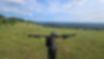
Beyond St Martha’s the trail carried us on to Newlands Corner, a popular viewpoint with a café and visitor centre – perfect for a water bottle refill and snacks. From this high ridge, you can look south across the Weald, and it’s easy to see why the North Downs formed a natural line of defence during the Second World War. The route still passes a number of concrete pillboxes and fortifications, part of a chain of defences known as the “GHQ Line,” constructed in 1940 to slow a potential German advance.
From Newlands Corner we rolled across Ranmore Common, descended through the vines of Denbies Wine Estate, and then faced the most famous climb in the South East: Box Hill. Its twisting S-bends have long been a testing ground for local cyclists, but it was the 2012 London Olympic road race that put Box Hill firmly on the world map. For Marcus and Tim, this was their first time up the zig-zags – a rite of passage – so a celebratory stop at the summit café just before 3pm was non-negotiable.


Singletrack, views, and home
The afternoon continued over Headley Heath, where gorse and heather lined swooping trails, and on towards Colley Hill, with its wide views over Surrey. The long descent through Gatton Park signalled the day’s end, dropping us neatly into Merstham.
Being so close to home, we had the luxury of dinner and a familiar bed before regrouping in the morning for day two. For now though day one was complete: a ride of varied trails, familiar climbs, and fresh perspectives on the Surrey Hills. Much of it was through areas we know well as it’s our mountain biking back yard. And while the route works on any bike, it’s brilliant fun on a full-suspension MTB, letting you really make the most of the oodles of swooping singletrack hidden along the ridge.

Day 2 - Merstham to Maidstone
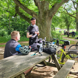
We reconvened at Merstham train station at 9am, bikes loaded up for our overnight in Maidstone. The weather had blessed us again – another fine early summer morning, blue skies above and the promise of a long day’s riding ahead. The first climb out of Merstham, up towards Chaldon, was a rude awakening for legs still remembering yesterday. Steep and punchy, it was a reminder that the North Downs rarely give up their views without a fight. From the top the ridge opened up, with broad panoramas over the Weald once again.
This was a stretch I’d only visited once or twice before, more often glimpsed from the busy M25 which passes beneath. The leeward side of the hill is dotted with disused chalk quarries, their gouged white scars like bite marks in an apple. To me they hold a certain adventurous curiosity, no doubt bolstered by their role as the setting for Saturday Adventure by John Pudney. Written in the 1950s, the story imagines two boys stumbling upon “Z Camp,” a secret research site where spies wield “Spy-Ray” — a kind of radioactive telepathy — against an unnamed enemy.
Of course, we didn’t encounter Uncle George or any shadowy espionage facilities on our ride, but little did we know the next twenty miles of the North Downs Way would prove to be our own adversary.


A tricky section east of Oxted
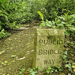
This part of the cycling route is where the North Downs Way diverges most noticeably from the walkers’ path. The stretch from Marden Park, just south of Woldingham, all the way to Heaverham (north-east of Sevenoaks) is public footpath only, so the cycling trail has to detour around it. Either that or you take your chance on the mix of quite lanes and fast B roads that stick to the ridge. On the map the detour looks simple enough, but on the ground we found it a different story – a frustrating sequence of undulating bridleways, short sharp climbs, and constant twists. A total contrast to yesterdays fast, flowy trails.
The upside is that the route drops into Oxted, a handsome little town and a good place to resupply. We stopped for lunch, coffee, and extra snacks – much needed for the miles to come. Still, progress was slow: the rollercoaster terrain, constant route finding and the still, airless forest made it hard going. By the time we reached the Ide Hill Community Shop & Café at 2:30pm, we were ready for a breather. Five hours of riding for only twenty miles tells its own story.


Into Kent
From Ide Hill the route turned north, briefly skirting the grounds of Ightham Mote, a 14th-century moated manor house now cared for by the National Trust. After weaving through farmland and woodland tracks, we finally rejoined the “true” North Downs Way at Heaverham, 35 miles in.
The character of the ride changed immediately. The chalky downland trails returned underwheel, our speed picked up, and the familiar wide-open views across the Weald lifted our spirits. After hours of slow progress, we were finally making up time.
The route carried us over the River Medway, a broad sweep of water once vital for trade and industry, now spanned by a cycle-friendly bridge linking old quarries and new housing at Peters Village. From here the trail would have turned skyward again, climbing steadily towards Blue Bell Hill, however tired of the mornings up and down roller coaster terrain, we foolishly decided to chop the hill climb from the route, only to substitute it with probably the most dangerous selection of road in the UK. Emerging just about unscathed from the carriageway-of-entrapment, we'd also missed Kit’s Coty House, a Neolithic chambered long barrow that has stood for over 5,000 years. As the sun was dipping low and we'd spied our pub and lodgings for the night, we rolled gratefully into The Lower Bell pub at 7:30pm – tired, dusty, and looking forward to a shower and rest.


Evening at The Lower Bell
A pint apiece in the pub was a decent reward. Food, however, proved trickier: the nearby diner was closed, and we’d missed the pizza cut-off back at the bar. Dinner ended up being a petrol station haul of Pot Noodles and other questionable delights – hardly the feast we’d been dreaming of all day, but in its own strange way a memorable end to a long ride. Thankfully, the pub lodgings more than made up for it: clean, comfortable, and right on the route. After ten hours in the saddle, it felt like luxury. Day two had been tougher than expected – a blend of slow, navigationally tricky miles and glorious fast chalk tracks once the Downs returned. A true test of patience and persistence, but one that set us up perfectly for the final push to Dover.


Day 3 - Maidstone to Dover
We rolled away from The Lower Bell early, setting off at 7:30am into fresher, cooler air than the day before. A light breeze and blue skies – perfect riding conditions for the final leg to Dover.
Picking up National Cycle Network Route 17, the riding was immediately rewarding: fast gravel tracks, chalk and flint underwheel, and wide views off to the right. At Detling, we crossed the busy A249, a reminder of modern England cutting across the ancient Downs, before settling back into quieter trails.
This section of the North Downs Way flits in and out of the historic Pilgrims Way, and the sense of history is never far away. The trail itself feels tailor-made for gravel bikes: flowing doubletrack, woodland paths, and the occasional punchy climb.
We passed the Dirty Habit pub at Hollingbourne (sadly closed for refurbishment), and soon after came across the Pilgrims Rest statue – a wooden friar carved on a bench, a nod to the countless travellers who have followed this route for centuries. Further on, the Lenham Cross, a giant chalk memorial cut into the hillside in 1922 to honour those lost in the First World War, stood stark against the Downs.


Across Kent
Lunch was a simple but satisfying stop, sitting on the grass outside the gatehouse of Eastwell House, once a grand estate and now a hotel. From here, our route diverged from the official Cycling UK line and away from NCN 17. Rather than looping north towards Canterbury, we'd planned for a straighter point-to-point ride, direct to Dover. Skirting north of Ashford, we picked up the reverse loop of the original route near Wye, also a convenient point to stop at the cycling friendly The Hub Cafe, for tea and cake. It was a perfect refueling stop before the toughest climb of the day: an impossibly steep bike push beside Round Down Wood at Stowting, dragging our bikes up to regain the ridge at the B2068 Stone Street. From there the ridge way riding continued again, carrying us south east through Lyminge and on towards the coast.


The finish at Dover
As we crested the Downs above Folkestone, the wind picked up and the town sprawled below us. The sea shimmered in the distance, drawing us onwards. Much of the run into Dover we already knew from riding the Cantii Way, though seeing it from the opposite direction gave the descent a new sense of momentum. Before the final roll down, we paused on Abbot’s Cliff, where the concrete curve of a sound mirror still faces the Channel. Built in the 1920s and 30s, these huge acoustic dishes were designed to detect approaching enemy aircraft long before radar existed. Standing here, it was easy to imagine the tension of those years, with the sea ahead not just a horizon but a frontline. From Reigate Hill and the pillboxes around Box Hill on day 1, we had in fact traced the line of England’s wartime defences eastwards.

And then, at last, the trail delivered us to the seafront, to the official North Downs Way finish point overlooking the Channel. Three days, 137 miles, 3,000 metres of climbing – and the perfect conclusion to a route that mixes ancient history, chalk landscapes, and some of the South East’s best riding. A great day’s cycling, and a fitting end to the North Downs Way.

How we cycled The North Downs Way
Route
137 miles (220km) | 3050m ascent | 18 climbs | max grade 17%
The walkers version of the North Downs Way is one of England’s great National Trails, tracing 153 miles of ancient trackways from Farnham in Surrey to a loop above Dover on the Kent coast. For those on foot, the route is a well-established classic, but thanks to Cycling UK, there is an official cycling version that follows much of the walking route, interspersed with linking bridleways, back lanes, and woodland singletrack.
The version featured in this blog is a shortened, more direct version of the Cycling UK "riders route", cutting out the loop to Canterbury and travelling direct to Dover from Ashford. This route is 137 miles long, features just over 3,000m of climbing, which we split over three days.
If you've already ridden the Cantii Way or are planning to do so, then this particular variation of the Cycling UK riders route avoids some of the overlap. It also makes for an achievable three day trip of roughly 45 miles per day and enjoys a satisfying end right on the Dover sea-front.
Clicking on the map (title) above takes you to the Ride with GPS route I used for this adventure. Other than the obvious differences from the original described above, it largely follows the same route and uses the same trails. The start of the route is located at the walkers North Downs Way trail marker in Farnham, next to the train station, in contrast to the start at Farnham Castle. And being a Dover finish the route again ends at the North Downs Way trail marker as opposed to the village of Wye. Please feel free to download and modify to suit. Alternatively you can download the original Cycling UK route here
Audax Card
Day 1 - Farnham to Merstham. 41 miles (66km) | 825m ascent | max grade 12.2%
Farnham, Puttenham (10), Shalford (16), Newlands Corner (21), Ranmoor Common (25), Boxhill (30), Headley Heath (34), Colley Hill (38), Gatton Bottom / Merstham (41)
Day 2 - Merstham to Maidstone. 48.5 miles (78km) | 1330m ascent | max grade 17%
Merstham, A22 / Godstone Road (5), Oxted (9), Toys Hill (16.5), Ide Hill Cafe (19), A21 Sevenoaks Bypass (23.5), Ightham Moat (28), Wrotham / M20 (36), Halling (42), Burham (46), Lower Warren Road / A229 / Lower Bell Inn (48.5)
Day 3 - Maidstone to Dover. 47.5 miles (76.5km) | 840m ascent | max grade 14.5%
Lower Warren Road / A229 / Lower Bell Inn, Detling (3.5), *Lenham (11.5), *Charring (16), *Ashford (20), Wye (24.5), Stowting / Bike push (32), Lyminge (35), *Folkestone (34), Dover (47.5)
* indicates locations just off the main route


Getting to the start
Both the start at Farnham and the finish at Dover are well connected with road and train links. However being a one way journey some consideration is needed for both ends of the route. In general the rail links run in and out of London so getting from Dover to Farnham may involve at least one trip into and out of London to get from one line to the other. Also be aware that if you choose to undertake the route over a weekday, many of the train companies operate cycle policies that preclude bikes between rush hour times times as they are mostly London commuter trains.
Parking is fairly good at both ends, Farnham being slightly easier. Using two cars, and leaving one at the end ready for the return, is a viable option, albeit the driving time between Farnham and Dover is around 2 hours.
Due to living very close to the route, we all used a combination of trains to get to the start, albeit we had to be creative with the timings to avoid the commuter periods. We had the luxury of the use of Tim's car at Dover to get us home.
Terrain
Approximately: 56% paved | 44% unpaved
The route has a pretty even split of on and off-road sections and with the 3000m of climbing - if taken over three days - makes for a manageable adventure. There are a few climbs at Newlands Corner, Boxhill, Burham and Wye Downs that could test the legs, but all doable with low gearing. The terrain really splits itself into two halves. While most of the geology is chalky flint, the first half is quite wooded so is more hard packed dirt/mud and plenty of swooping singletrack. There is a small section of sand around St. Martha's Church and the surrounding area but it is fairly short overall. The second half of the route opens up onto chalky downland, similar to the South Downs Way albeit not as exposed. If you have the time (and the legs) you could take a detour off the route on day 1 to head over to Holmbury Hill and Leith Hill to take in some of Surrey Hills finest MTB trails, the likes of Summer Lightning, Barry Knows Best and Yoghurt Pots. The first two thirds of day 2, where the route diverts away from the ridge proper (Woldingham to Heaverham) is a little faffy. It's a zig-zag route that avoids the roads but manages to encompass a whole bunch of short, sharp - up and down terrain - which isn't particularly flowing. But stick with it and accept the slower progress as the route will open out again and you'll have an opportunity to pick up the pace again later in the day.


When to go
Given the routes general elevation and mostly free draining chalky surface it could be a route to enjoy late into the year as well as the popular summer season. However, having ridden most of the trails from Farnham to Merstham over many years and in all seasons, the first part of this route can turn into a real mud-fest in late Autumn, Winter and Spring - and chalk gets incredibly slippery when wet. Aim for dry weather between late April and early November.
The Surrey Hills are also very popular with all trail users - from cyclists & horse riders to young families out for a short walk. They can get very busy in good weather particularly at the weekends. Take a bell and say hi!
Accommodation
Due to living close to the route we only stayed over on the second day:
Day 2 - Lower Bell Inn, 201 Old Chatham Road, Bluebell Hill, Aylesford, Kent. ME20 7EF. +44 (0) 1634 861 127
Eating
The route is never far from civilisation at any point along its length. Being a mecca for all things cycling, the Surrey Hills section is well blessed with cafes and bike shops in most of the towns and there's plenty of convenience shops to stock up on supplies throughout. You're also never far from a pub if you fancy pub grub or a cheeky pint and at the weekends there's a number of pop up coffee and ice cream vans at popular car parks which coincide with the route. The eastern section of Kent is a little less catered for, and you'll need to come down off the ridge, but again it's generally well serviced. If you choose to stay over in Maidstone town on the second night then there's plenty of pubs and restaurants to choose from. However if you want to stay closer to the route, as we did, then do thoroughly check food arrangements before hand. We stopped for drinks or food at the following places:
Watts Gallery Cafe - Watts Gallery, Down Lane, Compton, Surrey, GU3 1DQ
Newlands Corner Cafe - Newland's Corner, Albury, Guildford. GU4 8SE
Box Hill Cafe - Zig Zag Rd, Tadworth KT20 7LB
Little Waitrose - 159 Station Rd E, Oxted RH8 0QE
Ide Hill Community Shop - Ide Hill, Sevenoaks TN14 6JG
Shell Petrol Station - A229, Northbound, Aylesford ME20 7EZ
The Hub - Wye - Riverside House, Wye, Ashford TN25 5BX

Convenience stuff
In much the same vein as finding somewhere to eat along the route, bike shops, toilets and local shops are well catered for throughout. On the route itself there are plenty of secluded areas for a quick stop if you're comfortable with peeing in the woods (leave no trace!). A quick Google anywhere along the route will generally show close proximity to general amenities.
Equipment
Bike Between us we had two full suspension XC bikes and a flat bar gravel bike. For me, given my affinity to the MTB trails over the Surrey Hills, I'd always take my full susser, but a hardtail MTB, gravel bike or suitably equipped hybrid is fine. Marcus did struggle with the jaring terrain a little on the first half of day 2 on his fat tyre hybrid, but given his bike sports a 3x crankset, he benefited from the lowest gearing out of all of us - a definite plus for the steeper climbs. General equipment We chose to keep kit to a minimum, share tools and find food along the way. As a result we all carried a variation of my kit list below: Kit list:
Felt Edict, full suspension XC mountain bike, running Vittoria Mezcal tyres and 36T x 11-40t gearing (24 gear inches lowest gear).
Bikepacking bags (8 ltrs total): Wizard Works Lil Presto bar bag (1.8 ltr), no-name water bottle handlebar bag (o.5 ltr), Tailfin top tube bag - zip (0.8 ltr), Topeak top tube bag, between top tube and seat post (0.5ltr), self-made frame bag (3 ltr), Topeak seat pack (0.5 ltr). Camelbak with 1.5 litre water bladder.
Cycling clothes: Helmet, gloves, glasses, cycling shoes, cycling shorts (bibs), wool cycle jersey, windproof cycle gilet, arm warmers, neck buff, overshoes and waterproof jacket. Spare set of bib shorts, cycle jersey and gloves.
Overnight clothes: Sports shorts, long sleeve thermal top, grippy toe socks.
Wash kit, towel and first aid / medical items. Inc. chamois cream and sun cream.
Snacks.
1.5 ltr water in camelbak.
Mobile phone, Garmin 830 GPS, GoPro Hero 10, 240v charger, 5,000mAh battery, USB cables.
Front and rear lights, bike lock, bell.
Comprehensive set of bike tools, innertube, pump, CO2 gas, chain lubricant, tyre sealant, spare bike parts (derailleur hanger, bolts, cables etc.)

Is there an alternate route for day 2?
Specifically, is there a back lane / road cycling route that better mimics the walkers North Downs / Pilgrims Way route between Woldingham and Heaverham, to avoid such a big detour? I guess the good people at Cycling UK wrangled over that question for some time before deciding on the route that extends so far south. They probably did their research, drew a blank at gaining shared use of the footpaths for cyclists and the final incarnation was the best available option. Before the ride, I'd had a couple of goes at finding a route myself. It was a desk top exercise, via OS mapping and Google Street View, and it yielded a fair number of quiet back lanes that stick nicely to the ridge. However, they're interspersed with sections of fast B road and less than ideal places to bridge the myriad of motorways that criss-cross the area. Although I suggest a number of types of bike being suitable for the route, in its current form it's definitely best for a hardtail mountain bike with fast rolling tyres. While on paper there are plenty of road sections to tempt away from this choice, the trails on day 1 and the undulating, rough terrain on the first half of day 2 more than justify its use. However, if a back lane / road section could be found on day 2, when coupled with the fast gravel tracks of day 3, any slight underbiking on day 1 from using a Gravel bike (or better still an Adventure Bike) would be more than compensated.

Final thoughts
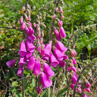
The North Downs Way by bike turned out to be a route full of contrasts: ancient stone churches and concrete wartime defences; shaded woodland singletrack and chalky gravel tracks with panoramic views. Riding it in late spring meant long days, dry trails, and wildflowers lining the chalky paths. And splitting the journey into three stages gave us time to absorb more than just the miles, it allowed us to enjoy the cafés, landmarks, and quiet moments along the way.
For us, the North Downs are our home turf – our mountain biking back yard – yet linking Farnham to Dover gave the familiar trails a new sense of purpose. It’s a route that works on any off-road bike where you’ll get the most out of its endless variety: chalk and flint descents, woodland singletrack, farm tracks, and the odd steep push.
Most of all, the ride reminded us what makes the Downs special: history woven into every mile, a sense of journey across the landscape, and the satisfaction of finishing with the Channel at your wheels. A fitting conclusion to a classic English trail, and a ride we’d recommend to anyone looking for a multi-day adventure close to London.
Happy Adventuring!
