
Traws Eryri
- Nick

- Aug 3, 2025
- 17 min read
Updated: Aug 27, 2025
Cycling UK's, 120 mile Traws Eryri route had been everything I’d hoped for—wild, challenging, beautiful—and, at times, downright hard. A brilliant, tough route—the kind of ride that stays with you long after the legs stop aching.
Click here if you want to navigate straight to the section on How I cycled Traws Eryri.
Day 1 - Machynlleth to Penmaenpool
There were three of us on this trip, each with our own mission. I was setting out to ride the full 120 miles of Cycling UK’s Traws Eryri route, James, my son, was taking on sections of the Snowdonia Way on foot, and my wife Louise was our ever-reliable logistics mastermind—choosing, wisely, to spend her nights in cosy rooms with crisp sheets rather than share our well-worn two-person tent.
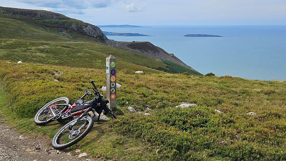
By the time we’d completed the long drive that morning, the sun was already well into its arc. It was past midday when I finally rolled out of Machynlleth, easing into the gradual climb north towards Corris. It was good to see the Millennium Bridge and extensive road works finally complete, formerly a scene of construction during my last trip cycling NCN 8 Lon Las Cymru. The route shadowed the gentle Afon Dulas, the water flashing silver between alder and willow as it picked its way over the shallow rocks. I passed the Dyfi Bike Park, the quietly intriguing Centre for Alternative Technology, and scattering of hamlets that felt as if they’d grown out of the hills themselves.

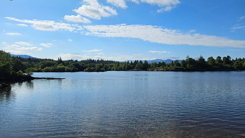
Corris came and went in a blur of slate and stone, followed—rather unexpectedly—by the deafening roar of two F-35 Lightning fighter jets carving the sky, their shadows chasing each other down the valley. Soon after, I swung left, leaving the shelter of the trees to join the winding A487. Cresting a rise, the scene suddenly widened: Llyn Myngul lay shimmering below, cradled in the vast shadow of Cadair Idris, as if the mountain itself was standing guard.


The descent to the lakeshore was a gift to tired legs, the trail hugging the water in a ribbon of smooth, easy riding. which continued for a while as I turned away from the lake heading west. I passed beneath the looming presence of Craig yr Aderyn - Bird Rock - its sheer, almost Jurassic looking crag, rising abruptly from the valley floor, home to nesting cormorants and swirling flocks of choughs.

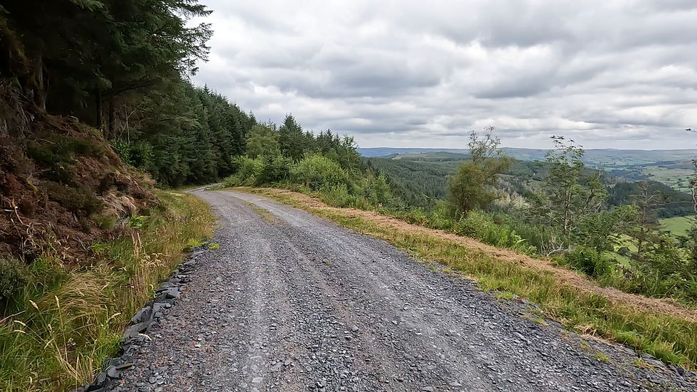
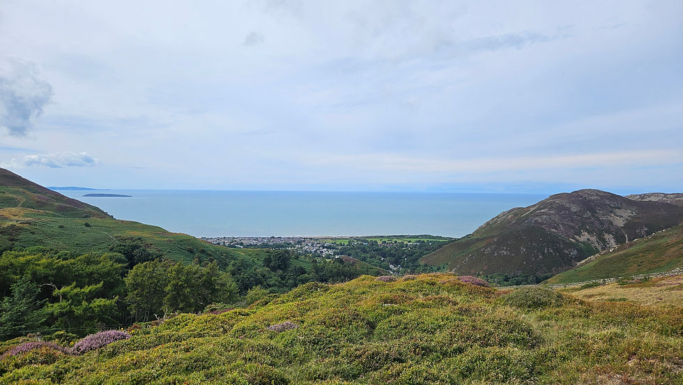
Beyond Abergynolwyn the gradient turned against me, and the climb into the high ground began. Here, the land shifted. Now wild and open with pot holed gravel tracks, shattered pine forests and disused heavy plant, it led me deep into the southeastern flanks of the Cadair. Two off-road motorcyclists, dripping with spray from puddles the size of bathtubs, roared past with a wave, leaving me to weave a careful line through the bracken where the ground offered some semblance of dryness. Then the forest began to thin, and the air smelt faintly of salt. Barmouth appeared in the distance, the sea flashing between the trees, before the track tipped down into the valley in a sweeping, glorious descent.


By late afternoon the sky was sliding into gold. I joined the Mawddach Trail, a wide gravel path tracing the estuary’s edge, where the still water mirrored the clouds and the world felt unhurried. Graig Wen campsite was just ahead, perfectly placed with bike-friendly access straight from the trail.
Tent pitched, kit stowed, I found James and Louise again, and together we wandered to the George III in Penmaenpool. A pint of Unicorn, a plate of hot food, and the glow of a day well-spent made the evening feel like the perfect prelude to the days ahead.

Day 2 - Penmaenpool to Trawsfynydd
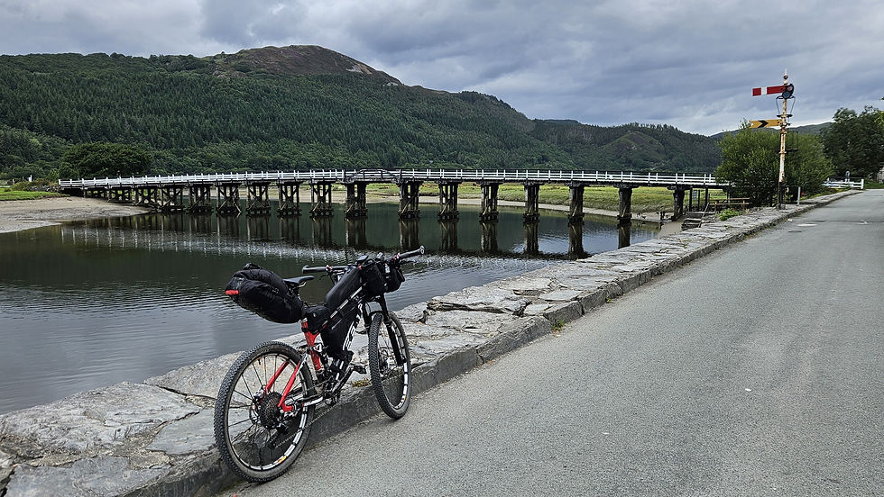
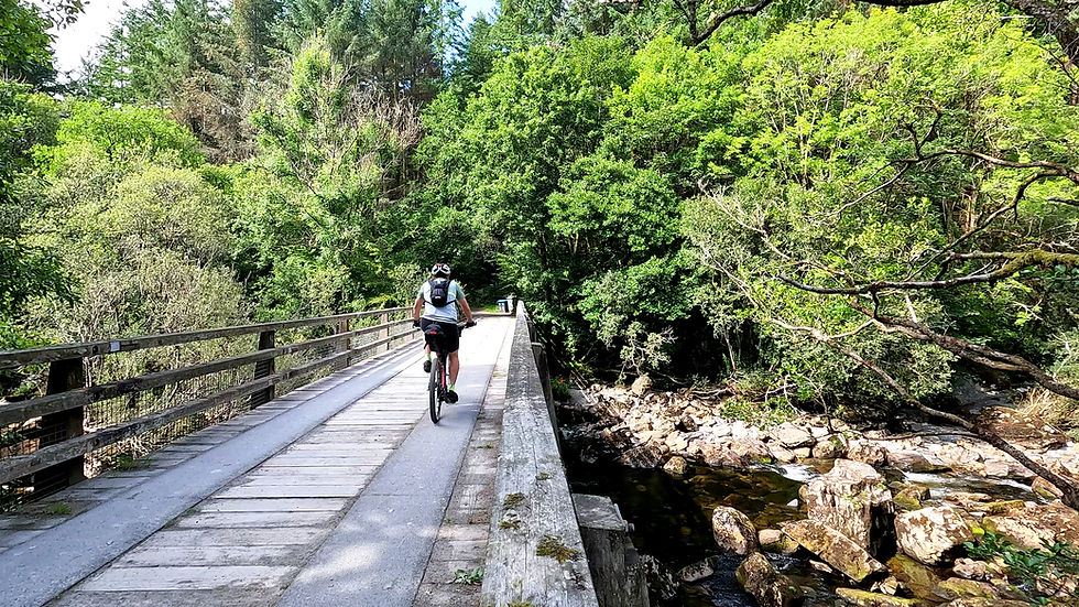
The morning in Penmaenpool started cool, the air damp with the scent of the estuary, but the clouds were lifting and the warmth was already building—an unspoken promise of a hot day to come. I rolled away from the campsite and, before reaching the bridge, passed a pair of weathered old railway signals standing like sentinels from another age, relics of the Mawddach line. Then came the creak of the Grade II–listed wooden boards beneath my tyres, fifty pence lighter after dropping a coin into the honesty box for the toll.

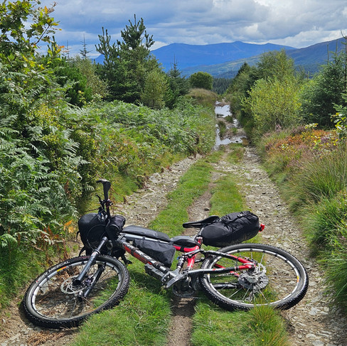
On the far side, the first climb of the day announced itself without ceremony—sea level to 350 metres in just over four miles. The gradient bit early, the route a shifting patchwork of tarmac and gravel, following the Afon Cwm-Mynach upstream into a hushed world of mossy banks and tall, dappled woodland. I found myself quietly grateful for the decision to fit extra-low gearing to the bike before the trip - a 46t rear cassette instead of the usual 11-40t. Without it, the slow grind up these early slopes would have been a far tougher test; in much the same way I struggled on the South Downs Way.
Around Llyn Cwm Mynach, that prehistoric feel returned—the kind that makes you wonder how little this place has changed in a thousand years. Ferns unfurled between mossy boulders, purple heather spilled across the slopes, and tall foxgloves stood like sentries at the forest edge. The dark pines closed in, and for a while, the outside world felt very far away. Yet even here, hints of human history whispered through the landscape—the remains of old mine workings hidden just out of sight, silent echoes of the slate industry that shaped these hills for centuries.


Beyond the lake, the trees thinned and the land rolled away in all directions, the climb at last surrendering. The descent on the other side was a mixed blessing—a loose, rocky surface that flattened out but demanded just as much focus as a steep drop. Every moment required careful balance between feathering the brakes and steadying the twitching front wheel down the loose stones, turning what should have been a relief into a test of nerve and skill. As unjust reward for the mornings efforts, Coed y Brenin MTB park's café shutters were firmly closed. I'd read about its uncertainty as an ongoing operation, but given the trails and bike shop are still open, I foolishly thought the cafe would be too. Lunch therefore became an impromptu picnic: the last of my trail mix, a handful of Jelly Babies, and a solitary Cliff Bar rescued from my bag. Hardly gourmet, but enough to quiet the appetite.


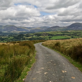
Then came the second great climb of the day, and with it, history. Sarn Helen—an old Roman road running from Conwy to Carmarthen—pulled me northward. Its ancient line rose steadily through a changing palette: rowan trees heavy with blood-red berries, ferns arching like the ribs of some long-forgotten beast, and swathes of pink heather edging the orderly ranks of plantation pines. Higher still, the trees loosened their grip on the land and the ride took on a wilder, more open character.


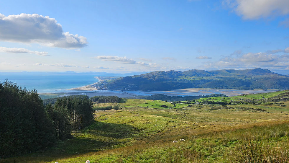
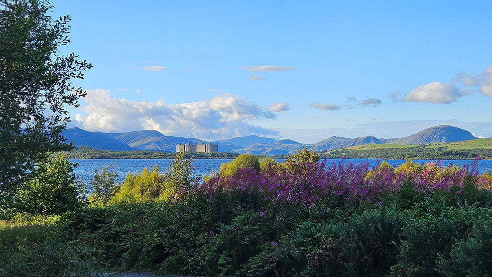
Here, the wind carried a different tone, sweeping over the hills as the narrow single-track road wound onward. And then, as so often in Snowdonia, the reward came in one slow, deliberate reveal: the long blue stretch of Trawsfynydd lake below, the town clustered at its edge, and on the far shore the unmistakable silhouette of the old nuclear power station—its concrete mass silent, almost contemplative against the water.

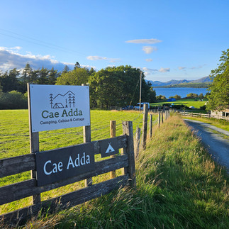
Meeting up with James again, Cae Adda campsite welcomed us with a touch of unexpected luxury: a warm campers’ room with kettle, fridge, and microwave, all within earshot of gentle waves lapping the shoreline. Though today’s ride was relatively short, the two tough climbs felt heavier with the weight of a fully loaded bike—each pedal stroke a reminder that effort multiplies when carrying all you need. It was, in fact, a steady build-up, a quiet promise that tomorrow would demand twice the distance and climb twice as high.


Day 3- Trawsfynydd to Betws-y-coed
The first half of the day took me into the Ffestiniog mountains—a place I hadn’t been since early childhood. Back then, it was with my family on a wet, windswept afternoon, huddled in our Peter Storm cagoules, getting the full brunt of the Welsh weather. This time, I was back as part of the longest day on my Traws Eryri ride: 40 miles and around 1,400 metres of climbing.
The day began with a loop around Llyn Trawsfynydd, where green ferns, gnarled trees, and moss-covered rocks framed the glassy black - onyx looking - water, set in stark contrast to the looming, dystopian silhouette of the old nuclear power station.


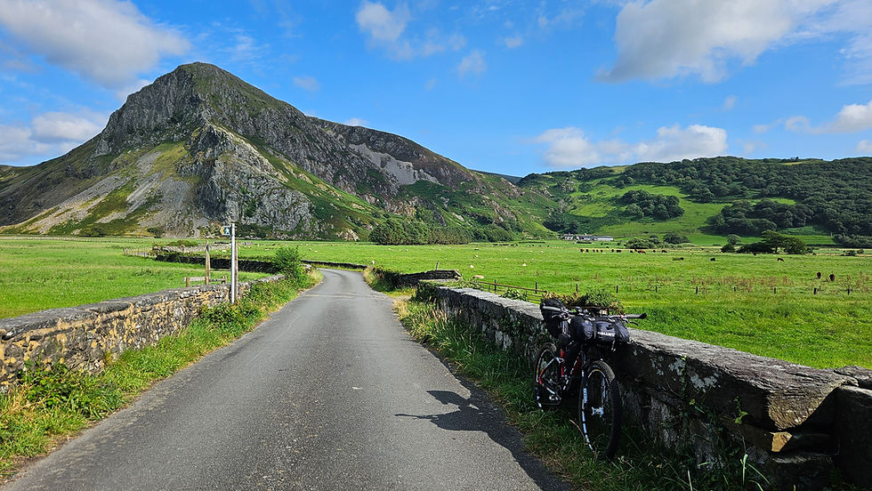
After crossing the A470, the scenery shifted, and the ride doubled in effort. Steep, energy sapping, grassy hike-a-bike sections cut through sheep-filled fields. A short drop back onto the A470 offered a moment’s relief, before the landscape opened up again into wilder terrain. A single ribbon of tarmac carried me upwards into Ffestiniog proper, towards the junction at Ffynnon Eidda, with sweeping views all around. The descent alongside Cwm Hafodyredwydd felt more like somewhere in the French Alps— switchbacks and long fast lines. I hit 30 mph and with the weight of the loaded bike, managed to boil the hydraulic fluid in my front brake! (And that wouldn’t be the last time).


Next came the second half of the route—two twisting legs weaving through managed forests on wide gravel tracks, each crowned with its now obligatory, soul-testing climb. The first weaving leg was a welcome respite—a peaceful, almost remote ride through quiet woods, where I paused for a simple lunch of oatcakes and Primula cheese, perched on a log with the valley stretching away beneath me. Along the way, a group of riders on scrambling bikes struggled up the ridiculously steep path I was also pushing my bike up. They all tumbled off, save for one (no harm done), proving that sometimes two unpowered wheels hold the upper hand.


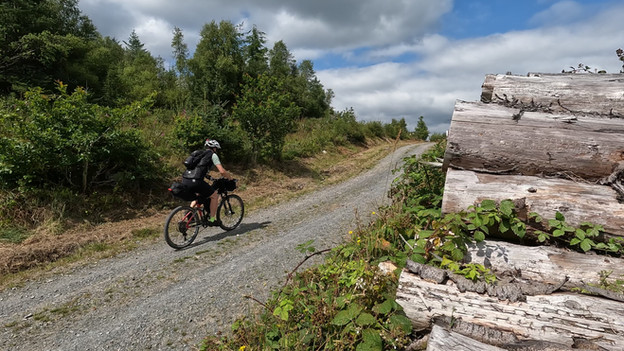
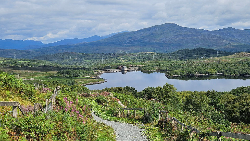
Crossing the charming bridge and passing the pretty waterfalls at Tan-aeldroch, I plunged onto the Sarn Helen road again for the second weaving leg. The terrain was tougher here, the climbs longer, and with the weight of my fully loaded bike wearing down my weary legs, the challenge deepened. But I pushed on through the remote mountain forest, circling the tranquil Llyn Elsi before descending into the postcard-perfect town of Betws-y-Coed.
Knowing a warm welcome—and a well-earned burger—awaited at the Royal Oak later, I pressed on, climbing the old A5 north of the river, before finally meeting James and Louise at Dolgam campsite.
That evening, while the burger hit the spot, it was the two pints of local ale that truly felt like a well-deserved reward for a day of hard-won adventure.
Day 4 - Betws-y-coed to Conwy
I'd enjoyed three days of near-perfect riding conditions—warm temperatures, a light breeze (even if it was mostly a headwind), and dry ground under the tyres. So it felt almost inevitable when we woke to the unmistakable sound of rain drumming on the tent fabric this morning. With my waterproofs going on and off in the first half hour, I pushed on towards Capel Curig and Plas y Brenin, the National Outdoor Centre—straight into a scene alive with runners and cyclists tackling a variety of local triathlons and duathlons. As the runners streamed past, I wound my way slowly along the Ogwen Valley, following the Snowdonia Slate Trail. My tyres skittered on wet rock and sank into boggy hollows, a 20 mph headwind funnelling straight into my face. However, even with my head bowed against the rain and low cloud, the jagged outlines of Tryfan, the Glyders, and the Carneddau loomed familiar—mountains I’d climbed and camped on in years past.


I’d been looking forward to this stretch as I’d only ever explored this area on foot or rope before, and it didn’t disappoint. First though, a much-needed tea and flapjack at the Ogwen café, sheltering from the tail end of the rain. Then came the joy of the old A5, its thin ribbon of tarmac carrying me swiftly down the stunning Nant Ffrancon valley. The road gave way to track again, skirting the eastern flank of the Penrhyn quarries—a literal mountain of shattered slate—before spitting me out north of Bethesda.


While navigating around Moel Wnion on the North Wales Path I met a fellow Traws Eryrion (a term I’d just coined on the spot). We agreed on two points: that Day 3 was tough, and that the whole route would be kinder without luggage on the bike. My brief riding partner peeled off to follow the A55 direct into Conwy, while I stuck to the guidebook route, climbing into the hills above Penmaenmawr. It was a stiff push, especially on day-four legs, but that near-the-end-of-the-route sense of achievement injecting a final boost of adrenaline to propel me on. With the clouds now lifted, the coast spread out below - framed by bursts of yellow gorse and patches of pink heather.


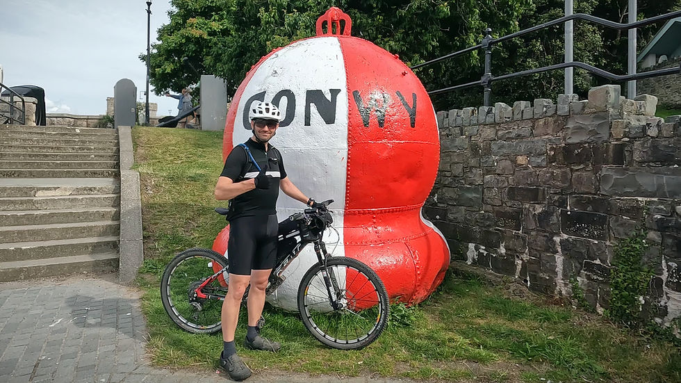
I skirted the infamous Traws Eryri "boggy bit" then it was one last brake-boiling descent from the top of the Sychnant Pass, and moments later I was rolling along the Conwy seafront.
A quick photo with the castle, a nod to the finish, and then on to collect James from his own epic adventure. Soft beds and home comforts awaited, but the Traws Eryri had left its mark—a brilliant route, and a tough one.
How I cycled Traws Eryri
Route
121 miles (200km) | 3,700m ascent | 16 climbs | max grade 13.4%
The route is just over 120 miles (200km) long and features a leg sapping *3,700m (12,000ft) of climbing. I split the route into 4 days as suggested in the Cycling UK guidebook, and carried full camping kit. The route shares sections of the brilliant NCN 8 Lon Las Cymru, NCN 82 (the Lon Las Cymru off-road alternate) and Euro Velo 2.
For much of the route you'll find yourself in the mountains and in remote places without phone coverage. Pack suitable clothing, be prepared for wild weather and carry additional means of navigation. I also carried a paper map plus the route downloaded on OS maps on my phone.
I've added some thoughts later on in this section regarding the amount of days to split the route over. You can skip straight to that here, although its probably worth reading on to understand the context behind the suggestions. *Figure as taken from Ride with GPS route planning software. Ordnance Survey mapping suggests the total ascent is nearer 4,380m of climbing, which is closer to Cycling UK's figures..
Clicking on the map (title) above takes you to the Ride with GPS route I used for this adventure. It's a very slightly modified version of Cycling UK's route, including the removal of the walk down the steep steps at Nant-y-Pandy and some corrections to minor blips in the original routing. The boggy area where the path crosses the stream at Ty’n-y-ffrith, just outside Conwy, has been left in, however the route cues detail the avoidable paths. Please feel free to download and modify to suit. Alternatively you can download the original Cycling UK route here
Audax Card
Day 1 - Machynlleth to Penmaenpool. 29 miles (47km) | 850m ascent | max grade 12.5%
Machynlleth, Corris (6), Llyn Mwyngil (10), *Abergynolwyn (13), Craig Yr Aderyn / Bird Rock (15.5), Peniarth (18), Llyn Cregennen (25),Arthog / Mawddach Trail (27.5), Graig Wen Campsite (29).
Day 2 - Penmaenpool to Trawsfynydd. 22 miles (35.5km) | 700m ascent | max grade 13%
Graig Wen Campsite, Penmaenpool tool bridge (3.5), Llyn Cum-mynach (7.5), A470 / Coed y Brenin (13), Blaenau Ffestiniog Cemetery (17.5), A470 south of Trawsfynydd (20), Cae Adda Campsite (22).
Day 3 - Trawsfynydd to Betws-y-coed. 41 miles (66km) | 1385m ascent | max grade 12.2%
Cae Adda Campsite, A470 north of Trawsfynydd (5.5), Cwm Cynfal viewpoint (11), *Penmachno (18), National Trust - Ty Mawr Wybrnant (26.5), A470 / Bridge / Campsite at Tan-aeldroch (28), Rhiwddolion (31), Betws-y-Coed (37), Dolgam Campsite (41).
Day 4 - Betws-y-Coed to Conwy. 32 miles (51.5km) | 800m ascent | max grade 11.7%
Dolgam Campsite, Plas y Brenin / National Outdoor Centre (4), A5 / eastern end Llyn Ogwen (8.5), Start of old A5 / YHA Idwal / Ogwen Cafe (10), A5 crossing north of Bethesda (16), Abergwyngregyn (21), Ty'n-y-ffrith / "boggy bit" (27), Sychnant Pass (29), Conwy (32).
* indicates locations just off the main route
Getting to the start
Given our combined family adventures we drove to the start at Machynlleth then Louise collected us both from Conwy and we drove home that night. It ended up being four days of cycling over four days of holiday. That said, during my original plans I had set out to drive and park the car at Machynlleth, complete the first day of the route on the same day, then catch the train from Conwy to Machynlleth on the fifth day and then drive home making the overall trip five days in total. There appear to be good trains that service both ends of the route, but for me they weren't direct enough resulting in potentially adding another day to the overall trip, making two days of travelling and four days of cycling.
Terrain
Approximately 55% paved & 45% unpaved
Interestingly, I found I spent so much physical time on the the unpaved, off-road sections, that it almost felt as though the whole route was off-road. Even the tarmac sections were narrow and remote. As a result - and also due to the technicality of the off-road terrain - I'd whole heartely recommend a mountain bike - and a full suspension XC bike if you have one. In terms of comparison, the route is similar in intensity to the South Downs Way and then some! Rocky, undulating and remote.


When to go
Given two significant factors: the four-seasons-in-one-day Welsh weather and the fact you're in the mountains, I'd definitely go between the months of May and September. Not only does this give you the best weather opportunity, you'll have the benefit of longer days and hopefully dryer trails.
Accommodation
Day 1 - Graig Wen Camping, Graig Wen, Arthog, Dolgellau LL39 1YP, 01341 250 482
Day 2 - Cae Adda Camping, Trawsfynydd, Blaenau Ffestiniog LL41 4TS, 07783 873 532
Day 3 - Dolgam Campsite, Dolgam, Capel Curig, Betws-y-Coed, Snowdonia LL24 0DS. 07375 682 769
Eating
The natural overnight locations suggested by Cycling UK, generally host a good selection of convenience stores, restaurants, pubs and hotels to cater for most requirements. Outside of this, the route gets very remote and its essential to cater for snacks and lunches in advance. If you're camping then considering breakfast would also be essential, albeit I found a number of cafe's serving breakfast within the first few miles of each day. In conjunction with self catering at the campsites on the way, I stopped for food at the following places:
The George III pub - Penmaenpool, Dolgellau LL40 1YJ
Coed-y-Brenin MTB centre - Coed y Brenin Forest Park, Dolgellau LL40 2HZ (CAFE NOT OPEN AT PRESENT)
Royal Oak Hotel - Holyhead Rd, Betws-y-Coed LL24 0AY
Outside of this, my original plans also considered the following locations:
The Cross Foxes Bunkhouse, Restaurant & Bar - Trawsfynydd, Blaenau Ffestiniog LL41 4SE
Canolfan Prysor Centre Cafe and Fishing Centre - Llyn Trawsfynydd Lake LL41 4DT
The Swallow Falls Inn - Holyhead Road, Betws-y-Coed LL24 0DW
Caffi Siabod - A5, Capel Curig, Betws-y-Coed LL24 0EL
Caffi Alma - Abergwyngregyn, Llanfairfechan, LL33 0LD
I didn't end up visiting any of these so I don't have first hand experience of their suitability. However they were researched and included based on other rider's feedback, reviews and positive recommendations.


Convenience stuff
The route is mainly offroad and in some places very remote, therefore any toilets will typically be located in towns, villages or cafe's. On the route itself there are plenty of secluded areas for a quick stop if you're comfortable with an outdoor view.
There are a number of convenience stores in the towns and villages the route passes through, supplying food, drink and essentials.
Bike repair and maintenance are relatively well catered for given the affinity of the area to mountain biking and cycling in general but again due to the remoteness of the route it may be a long trek to reach civilisation.
Equipment
Bike:
Cycling UK describes the route as being best for MTB's and I'd wholeheartedly endorse this. Of course if you're intending to ride the route on a gravel bike or hybrid then fit the widest tyres possible with a good off-road tread pattern and the lowest gearing you can. I carried a full camping set-up and fitted gearing to hit the magic 20 gear inches - and was so grateful for it. The route is definitely not suitable for a road bike. I'd also suggest a good selection of essential bike repair tools and spare parts due to the remoteness of the route in some locations. In the forest south of Betws-y-Coed, I bumped into a rider that had lost a bolt from one of his SPD cleats on his cycling shoe. Luckily he had alternate sided pedals and could ride on the flats until he got back to his car. I now carry a spare SPD bolt in my bikepacking kit! Kit:
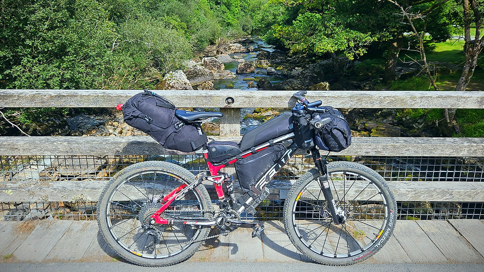
Felt Edict, full suspension XC mountain bike, running Vittoria Mezcal tyres and 36T x 11-46t gearing (20 gear inches lowest gear).
Bikepacking bags: Self-made bar roll/bag (13ltr), Topeak Backloader seat pack (10ltr), self-made frame bag (3ltrs), Tailfin (front) top tube bag (1.5ltr) plus a rear Topeak top tube bag (0.5ltr), Camelbak with 1.5 litre water bladder, 2 x bar/stem mounted water bottle holders.
Accomodation: Vango F10 Nexus UL2 tent
Sleeping: 2 season sleeping bag, Therm-a-rest NeoAir Xlite inflatable mattress and Sea-to-summit pillow, mini mattress inflater with light.
Cycling clothes: Helmet, gloves, glasses, cycling shoes, cycling shorts (bibs), wool cycle jersey, windproof cycle gilet, arm warmers, neck buff, overshoes and waterproof jacket. Spare set of bib shorts, cycle jersey(s) and gloves.
Casual clothes: lightweight trainers, Down jacket, zip off trousers, thin fleece, wool t-shirt, underwear,
Wash kit, towel and first aid / medical items. Inc. chamois cream and sun cream
Stove + gas, mug, spork
Food
1.5ltrs water in camelbak + 0.5ltr water bottle in bar mounted water bottle holder.
Mobile phone, Garmin 830 GPS, GoPro Hero 10, 240v charger, 10,000mAh battery, cables.
Front and rear lights, bike lock, bell.
Comprehensive set of bike tools, innertube, pump, CO2 gas, chain lubricant, tyre sealant, spare bike parts (derailleur hanger, bolts, cables etc.)
How many days to split the route over
As explained above, I set out to follow Cycling UK's suggestion for a more relaxing trip and opted to split the route into four days and to camp. I enjoy cycle camping and given I haven't bikepacked with my tent for a while I felt it was high time I based an adventure around it again.
During the preparation, I was heavily considering completing the route over three days. My benchmark for this was based on my South Downs Way adventure, where I cycled 67 miles with just under 2000m of climbing on day one. It was a long day, I was in the saddle 12 hours, but it included all the riding back and forth I do to capture the photos and video, so I felt comfortable with the distance and elevation. The main difference though was that I didn't camp so I had a far lighter bike.
During this trip, I was lucky enough to have Louise close to hand and off-loaded my overnight clothes, stove, tent and sleeping bag on the last day. And oh boy - it transformed the ride! Coincidentally, I met a rider on the last day and while sharing thoughts and stories of our respective adventures, he had also considered leaving his camping equipment at Betws-y-Coed and collecting it on the way back. He didn't, and as a result cut out the final hills above Penmaenmawr and went straight to Conwy via the A55 because of the weight of his bike.
So if I ever tackled Traws Eryri again, I'd definitely ditch the camping stuff and use B&B's / hostel's for the entire route, with a commensurate minimal set of equipment. The weight of the camping equipment on the bike shouldn't be underestimated, particularly on this terrain and with a headwind (as I had) for the entire journey, it makes it very challenging. Coincidentally while the campsites are situated in good locations along the route, they don't always offer a great start or end point to break the route into four equal days. My third day was overly long due to this.
If I was to tackle the route over three days, without deliberately cutting out any sections, I would pay close attention to the ascent rather than distance - and this would be my split:
Day 1 - Machynlleth to Trawsfynydd. 49 miles (79km) | 1540m ascent | max grade 13% I'd stay at the Cross Foxes at the end of day 1 and cycle straight from the junction of the A470 and Sarn Helen just south of the town. I'd tackle the Trawsfynydd lake loop on day 2. Day 2 - Trawsfynydd to Betws-y-Coed. 40 miles (65.6km) | 1215m ascent | max grade 12% I'd undertake the lap of the lake on this day and stay as close to the centre of Betws-y-Coed as possible overnight. Day 3 - Betws-y-Coed to Conwy. 34 miles (55km) | 950m ascent | max grade 11% Starting in Betws-y-Coed, I'd simply follow the guidebook route, including the hills above Penmaenmawr all the way to Conwy.

Final thoughts
Traws Eryri was everything I’d hoped for and more—an unforgettable four-day adventure across the heart of Snowdonia, from Machynlleth to the medieval walls of Conwy. Each day brought its own rhythm: sweeping gravel trails through ancient woodlands, wild singletrack over exposed hills, and tarmac ribbons twisting between slate-scarred mountains. There were moments of quiet solitude, log-side lunches, and unexpected encounters—from scrambling motorbikes to fellow riders battling the same climbs. The landscape was endlessly varied, shifting from the soft greens of valley ferns to the stark, otherworldly silhouettes of slate quarries and proud mountains, all set beneath the ever-changing Welsh skies.
While the fully loaded bike gave the trip a certain self-sufficient romance, it would definitely be more enjoyable with a lighter setup—swapping tent and cooking gear for the comfort of B&Bs, hostels, or hotels along the way. Without the extra weight, the climbs would sting less, the descents would flow faster, and there’d be more energy left for soaking up the scenery (and maybe one more pint at the end of the day). Still, the route was a tough, beautiful, and deeply rewarding ride—one I’ll remember for a long time.
Happy Adventuring!


Comments